Category:Maps of the Western Mediterranean
Jump to navigation
Jump to search
western portion of the Mediterranean Sea and surrounding areas  | |||||
| Upload media | |||||
| Instance of | |||||
|---|---|---|---|---|---|
| Part of | |||||
| Location |
| ||||
| Located in or next to body of water | |||||
| Connects with | |||||
| Has part(s) | |||||
| |||||
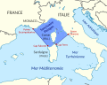
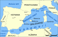
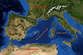
English: This category collects maps that show only the western part of the Mediterranean Sea (between Italy and Spain). This includes (from west to east) the Alboran Sea, the Balearic Sea, the Gulf of Lion, the Ligurian Sea, the Tyrrhenian Sea, the Strait of Sicily.
Subcategories
This category has the following 4 subcategories, out of 4 total.
Media in category "Maps of the Western Mediterranean"
The following 30 files are in this category, out of 30 total.
-
 Balearic Sea map.png 1,000 × 639; 77 KB
-
 Barcelona Italy blank 2.jpg 25,800 × 1,800; 9.68 MB
-
 Barcelona Italy blank.png 12,900 × 900; 11.5 MB
-
 Barcelona Italy.jpg 12,900 × 900; 3.14 MB
-
 Bay of Biscay map bs.svg 1,004 × 916; 244 KB
-
 Bay of Biscay map hr.svg 1,004 × 916; 244 KB
-
 Carte calanques marseille.jpg 3,307 × 844; 170 KB
-
 Corredor De Migración De Cetáceos Del Mediterráneo-fr.svg 550 × 420; 970 KB
-
 Fair Promontory.png 1,314 × 687; 74 KB
-
 Godos.gif 350 × 320; 22 KB
-
 Map FR-A 07.jpg 179 × 179; 38 KB
-
 Mapa miembros Arco Latino 2010.jpg 2,339 × 1,654; 395 KB
-
 Mar Ligure-fr.svg 1,338 × 1,303; 273 KB
-
 Mar Ligure-uk.svg 1,338 × 1,303; 264 KB
-
 Mar Ligure.svg 1,338 × 1,303; 263 KB
-
 Mediterranean Sea location map-2.png 480 × 499; 71 KB
-
 Campañas mediterráneas de Pero Niño 02.png 1,200 × 729; 277 KB
-
 OpenSeaMap-ChartBundleArea-MediWest-2016-05.PNG 1,348 × 754; 740 KB
-
 Ponient sea.jpg 1,149 × 799; 423 KB
-
 Sanctuaire Pelagos.svg 600 × 480; 992 KB
-
 Santuario dei cetacei.png 600 × 505; 103 KB
-
 South Chrome Dome.JPG 554 × 364; 132 KB
-
 The apostolic age; its life, doctrine, worship and polity (1899) (14595390629).jpg 1,675 × 1,992; 932 KB
-
 Trajectoire de la météorite du 16 août 2019.png 999 × 999; 339 KB
-
 Vahemere lääneosa.png 1,000 × 639; 211 KB
-
 Vandal Kingdom at its maximum extent in the 470s.png 1,575 × 1,104; 11 KB
-
 West Mediterranean sea topographic map.svg 812 × 408; 1.11 MB
-
 Western Mediterranian Sea He.jpg 1,167 × 769; 234 KB
-
 Лигурско Море.svg 1,338 × 1,303; 666 KB
-
 Bay of Biscay map.svg 1,004 × 916; 366 KB


_(14595390629).jpg)


