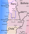
Category:Maps of the War of the Pacific-Occupation of Antofagasta
Jump to navigation
Jump to search
Media in category "Maps of the War of the Pacific-Occupation of Antofagasta"
The following 4 files are in this category, out of 4 total.
-
Mapa toma de calama 1879 (A.Machuca).png 1,029 × 687; 931 KB
-
Ocupacion de Antofagasta.es.svg 428 × 487; 53 KB
-
Quillagua-Ekdahl 1901.jpg 974 × 782; 341 KB
-
Ruta 5. division de Camacho, en 1879-80.svg 2,342 × 1,805; 7.97 MB


