Category:Maps of the Viking Age
Jump to navigation
Jump to search
Subcategories
This category has the following 2 subcategories, out of 2 total.
E
- Maps of Viking exploration (9 F)
M
Media in category "Maps of the Viking Age"
The following 143 files are in this category, out of 143 total.
-

-

-
 A short history of England and the British Empire (1915) (14763988301).jpg 1,832 × 1,816; 599 KB
-
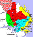
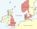 Cnut lands nl.svg 642 × 511; 385 KB
-
 Cnut lands th.svg 642 × 511; 183 KB
-
 Cnut lands-es.svg 642 × 511; 182 KB
-
 Cnut lands-pt.svg 642 × 511; 177 KB
-
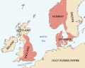 Cnut lands.svg 642 × 511; 211 KB
-
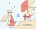
 Cnut-north-sea-empire (hy).png 907 × 715; 148 KB
-
 Danewerk.empty.png 633 × 634; 418 KB
-
 Danewerk.png 633 × 635; 525 KB
-
 DanewerkDetailmap.jpg 383 × 384; 178 KB
-
 DanewerkKograben.gif 1,098 × 984; 21 KB
-
 Dannevirke.english.png 2,045 × 2,048; 2.19 MB
-
 Dannevirke.png 2,045 × 2,048; 2.19 MB
-
 Denmark vikings 3.jpg 547 × 546; 142 KB
-
 Wikingerburgen.jpg 750 × 700; 77 KB
-
 Dänenausbreitung.png 683 × 786; 778 KB
-
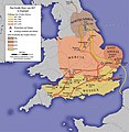
 Earldoms of Anglo-Saxon England-es.svg 398 × 475; 52 KB
-
 Earldoms of Anglo-Saxon England-pt.svg 398 × 475; 17 KB
-
 Earldoms of Anglo-Saxon England.svg 398 × 475; 17 KB
-
 Eirik-Raudes Groenland.jpg 400 × 437; 47 KB
-
 England 878-nl.svg 988 × 1,229; 1.53 MB
-
 England Grosses Heer 865.jpg 848 × 868; 144 KB
-
 England Grosses Heer 865.png 848 × 868; 711 KB
-
 England Grosses Heer 892.jpg 848 × 868; 146 KB
-
 England runestones.png 445 × 478; 124 KB
-
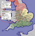 Eroberung des Danelags.jpg 848 × 868; 165 KB
-
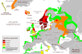
 Europe 843ad viking incursions map.png 2,621 × 1,414; 738 KB
-
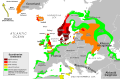 Viking Expansion.svg 800 × 524; 2.92 MB
-
 Faroe stamp 064 europe (viking route).jpg 320 × 278; 66 KB
-
 Folklands.png 723 × 817; 266 KB
-
 Fruehstadt Wolin-PL.jpg 800 × 800; 67 KB
-
 Fruehstadt Wolin.jpg 800 × 800; 69 KB
-
 Germanic-Nordic Tribes Migration to Germania Magna.gif 1,920 × 1,080; 1.49 MB
-
 Great Heathen Army-es.svg 551 × 551; 454 KB
-
 Great Heathen Army-fr.svg 551 × 551; 172 KB
-
 Great Heathen Army-pt.svg 551 × 551; 496 KB
-
 Greenland Vinland satellite lowres.jpg 269 × 346; 19 KB
-
 Grønlands–Noreg72c.png 600 × 910; 45 KB
-
 Halor viking market Skania Sweden.jpg 1,024 × 768; 76 KB
-
 Handelsplatz Reric.jpg 511 × 800; 58 KB
-
 Hjoernungavaag.jpg 1,000 × 828; 162 KB
-
 Illas Britanicas (vèrs la fin dau sègle IX).png 801 × 956; 244 KB
-
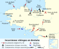 Incursions vikings en Bretagne-es.svg 1,112 × 916; 456 KB
-
 Incursions vikings en Bretagne-fr.svg 1,112 × 916; 238 KB
-
 Ivar.png 944 × 477; 647 KB
-
 Kart over fylkerne i det sydlige Norge.png 2,612 × 2,354; 4.56 MB
-
 Kart over fylkerne paa Vestlandet.png 2,664 × 3,847; 7.93 MB
-
 Kart over Haalogaland.png 1,280 × 3,778; 3.76 MB
-
 Kart over Nordmør, Romsdalen og Søndmør.png 1,352 × 3,692; 3.94 MB
-
 Kart over Oplandene (Ringerike).png 2,604 × 2,812; 7.39 MB
-
 Kart over Oplandene.png 2,604 × 2,812; 4.93 MB
-
 Kart over Sør-Noreg.png 5,749 × 7,284; 13.66 MB
-
 Kart over Viken.png 2,655 × 4,127; 7.9 MB
-
 Karte Danewerk dk.jpg 1,015 × 816; 282 KB
-
 Karte Danewerk.jpg 1,015 × 816; 288 KB
-
 Kingdom of Jorvik.png 278 × 245; 20 KB
-
 Kingdom of Jórvik.svg 278 × 245; 61 KB
-
 Map danavirki.JPG 1,600 × 1,200; 1.17 MB
-
 Map of thegn runestones.jpg 600 × 699; 32 KB
-
 Noreg-Grønland3.png 2,106 × 1,784; 183 KB
-
 Noreg16-3.png 837 × 1,323; 25 KB
-
 Noreg16.png 804 × 1,144; 29 KB
-
 Northeast.Irish.Sea.Norse.placenames.jpg 1,005 × 897; 282 KB
-
 Northern Europe in 814.jpg 1,476 × 946; 683 KB
-
 Norway 1000 AD-en.svg 716 × 789; 2.36 MB
-
 Norway 1000 AD-es.png 1,134 × 2,002; 416 KB
-
 Norway 1000 AD-es.svg 765 × 961; 2.16 MB
-
 Norway 1000 AD-fr.svg 716 × 789; 2.29 MB
-
 Norwegen Wikingerzeit unbeschriftet.JPG 575 × 750; 52 KB
-
 Norwegen Wikingerzeit.JPG 575 × 750; 83 KB
-
 Norwegian expansion 780-1380.jpg 1,500 × 714; 461 KB
-
 Norwegian.colonial.empire.jpg 1,365 × 974; 279 KB
-
 Nyafolkland.png 530 × 599; 221 KB
-
 Ostsiedlung.png 540 × 720; 54 KB
-
 Ribblehead Ausgrabung.jpg 600 × 742; 57 KB
-
 Ringborge.jpg 750 × 700; 84 KB
-
 Baltic area runestones.png 298 × 345; 48 KB
-
 Russland BV042518413.jpg 1,954 × 1,337; 326 KB
-
 Scandinavie, epoque Viking.png 550 × 750; 67 KB
-
 Sigurd Eysteinsson's Scotland.png 540 × 720; 112 KB
-
 Skandinavien Wikingerzeit unbeschriftet.JPG 550 × 750; 56 KB
-
 Skandinavische Ortsnamen in England.jpg 733 × 1,044; 395 KB
-
 Slavic raids on Scandinavia, Nar.Muz.Mor., Gdańsk, Poland.jpg 1,826 × 1,749; 767 KB
-
 Social Scandinavia in the Viking age (1920) (14761040776).jpg 1,846 × 2,214; 165 KB
-
 Social Scandinavia in the Viking age (1920) (14784034865).jpg 1,782 × 2,728; 311 KB
-
 South Yorkshire Place Names.png 737 × 511; 386 KB
-
 Sweden Settlement Younger Iron Age Sv.svg 383 × 660; 101 KB
-
 Territories and voyages of the Vikings blank.png 1,236 × 857; 332 KB
-
 Territories and Voyages of the Vikings blank.png 1,578 × 1,091; 1.77 MB
-
 Territories and voyages of the Vikings german.png 1,236 × 857; 566 KB
-
 Territories and voyages of the Vikings.png 1,236 × 857; 341 KB
-
 Territòris de Cnut lo Grand.png 722 × 665; 134 KB
-
 The voyages of the Norsemen to America (1914) (14762942631).jpg 4,378 × 2,976; 1.02 MB
-
 Tieberg-1827-28.jpg 725 × 1,043; 162 KB
-
 Tomrair (map).png 868 × 1,178; 283 KB
-
 Varangian Runestones.png 462 × 532; 118 KB
-
 Viikinkien retket.png 1,236 × 857; 406 KB
-
 Viken.png 2,655 × 4,127; 11.08 MB
-
 Viking Age trade routes in north-west Europe.png 994 × 967; 441 KB
-
 Viking Expansion AR Vector.svg 800 × 524; 924 KB
-
 Viking Expansion AR.svg 800 × 524; 662 KB
-
 Viking Expansion He.svg 793 × 521; 935 KB
-
 Viking Expansion hu.png 1,200 × 786; 362 KB
-
 Viking Expansion hu.svg 800 × 524; 3.53 MB
-
 Viking Expansion KO.svg 793 × 521; 829 KB
-
 Viking Expansion-ca.png 793 × 521; 142 KB
-
 Viking Expansion-es.svg 793 × 521; 1.33 MB
-
 Viking Expansion-fr.svg 793 × 521; 1.26 MB
-
 Viking Expansion-pt.svg 793 × 521; 869 KB
-
 Viking expansion.png 507 × 310; 109 KB
-
 Viking Incursions and Battles in Brittany.jpg 959 × 787; 177 KB
-
 Viking Raids in England 892-896-es.svg 685 × 539; 775 KB
-
 Viking Raids in England 892-896-fr.svg 685 × 539; 768 KB
-
 Viking Raids in England 892-896-pt.svg 685 × 539; 772 KB
-
 Viking ring fortress.svg 640 × 680; 750 KB
-
 Viking runestones.JPG 600 × 699; 47 KB
-
 Viking settlements in Ireland.png 257 × 318; 58 KB
-
 Viking settlements in North America.png 2,000 × 1,500; 686 KB
-
 Viking towns of Scandinavia 2.jpg 1,181 × 1,247; 289 KB
-
 Viking towns of Scandinavia.jpg 945 × 998; 95 KB
-
 Viking World Map.png 1,228 × 962; 45 KB
-
 Vikingen tijd.png 697 × 438; 116 KB
-
 Vikingenes ferdesveier og bosetninger.png 1,236 × 857; 330 KB
-
 Vikings exploration and territories-en.svg 1,500 × 600; 358 KB
-
 Vikings exploration and territories-fr.svg 1,500 × 600; 358 KB
-
 Vikings exploration and territories-hu.svg 1,500 × 600; 358 KB
-
 Vikings exploration and territories-pt.svg 1,500 × 600; 358 KB
-
 Vikings-Voyages-he.png 947 × 648; 739 KB
-
 Vikings-Voyages.png 800 × 547; 535 KB
-
 VikingsCarte.png 1,238 × 858; 522 KB
-
 Vikingų ekspansija Europoje.png 3,000 × 1,965; 906 KB
-
 Vikingų ekspansija.svg 800 × 524; 2.36 MB
-
 Vikingų kelionės.png 3,200 × 2,188; 9.02 MB
-
 Vinland-travel-hy.jpg 1,214 × 1,600; 488 KB
-
 Vinland-travel.jpg 1,214 × 1,600; 369 KB
-
 Vittfarne-pt.svg 800 × 147; 17 KB
-
 Vittfarne.jpg 958 × 176; 50 KB
-
 Westsiedlung.png 720 × 540; 61 KB
-
 WikingerKarte.jpg 1,394 × 1,152; 633 KB
-
 Züge, Landnahmen und Siedlungsgebiete der Nordmänner - 800-1050.png 4,026 × 2,502; 12.13 MB
-
 Հյուսիսծովյան կայսրություն.png 887 × 700; 188 KB
.jpg)
.jpg)
_(14763988301).jpg)


.png)


.jpg)


.png)


.png)


_(14761040776).jpg)
_(14784034865).jpg)


_(14762942631).jpg)

.png)


