Category:Maps of the United Kingdom of Great Britain and Ireland
Jump to navigation
Jump to search
Media in category "Maps of the United Kingdom of Great Britain and Ireland"
The following 8 files are in this category, out of 8 total.
-
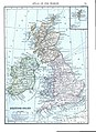 British Isles (1909).jpg 863 × 1,185; 805 KB
-
 Europe-United Kingdom (1921).svg 450 × 456; 855 KB
-
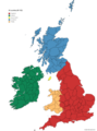
 Southern Ireland in the UK and Europe.svg 450 × 456; 1.15 MB
-
 UK 1914.svg 450 × 456; 477 KB
-
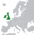
 UK of Britain & Ireland in Europe.png 1,218 × 1,245; 39 KB
-
 UK of Britain and Ireland in 1914.png 1,000 × 1,013; 381 KB
-
 United Kingdom of Great Britain and Ireland 1812.svg 450 × 456; 633 KB
-
 United Kingdom of Great Britain and Ireland.png 4,765 × 6,400; 2.41 MB
.jpg)
.svg)


