Category:Maps of the Territorial triangle dispute
Jump to navigation
Jump to search
Media in category "Maps of the Territorial triangle dispute"
The following 8 files are in this category, out of 8 total.
-
Chile-Perú, Punto Concordia.jpg 918 × 882; 132 KB
-
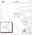
Comision-mixta-de-limites-peruano-chilena-1992.jpg 428 × 507; 67 KB
-
Complejo Chacalluta.png 850 × 1,100; 54 KB
-
Concordia-1973-mapa-arica-carta-nautica-chilena-101.jpg 693 × 487; 46 KB
-
Delimitación entre Chile y el Perú 3.png 401 × 400; 23 KB
-
Mapa enrique brieba concordia.jpg 586 × 822; 33 KB
-
Mapa-oficial-de-arica-1966.jpg 496 × 537; 47 KB
-
Punto-concordia-mapa-1941-instituo-geografico-militar-chile.jpg 945 × 574; 236 KB


