Category:Maps of the Taunus
Jump to navigation
Jump to search
Media in category "Maps of the Taunus"
The following 17 files are in this category, out of 17 total.
-

-
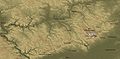 Geo Taunus.jpg 1,398 × 689; 301 KB
-
 Geologische Karte Taunus.png 3,120 × 2,556; 1.75 MB
-
 Goldgrube Lageplan.jpg 2,214 × 1,273; 826 KB
-
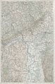
 Karte des Rheingan-Kreises - btv1b53060513q.jpg 8,274 × 6,738; 10.86 MB
-
 Karte des Rodheimer und Köpperner Waldes.jpg 8,014 × 6,297; 20.68 MB
-
 Karte Deutschland Taunus 2.png 188 × 235; 7 KB
-
 Karte Taunus Deutschland.png 188 × 235; 7 KB
-
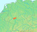 Location Taunus.PNG 506 × 439; 40 KB
-
 Mainz - 26-50.jpg 3,278 × 5,007; 3.25 MB
-
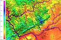 Relief Taunus.jpg 1,200 × 800; 390 KB
-
 Taunus - Deutsche Mittelgebirge, Serie A-de.png 2,300 × 1,500; 5.05 MB
-
 Taunus Naturräumliche Gliederung mit Relief.png 2,179 × 1,814; 5.03 MB
-
 Taunus Naturräumliche Gliederung.png 2,153 × 1,923; 563 KB
-
 Taunus.png 1,105 × 844; 1.74 MB
-
 TK-Karte Eppstein.jpg 3,024 × 4,032; 5.9 MB
-
 Topographische Karte vom oestlichen Taunus - von Ludwig Ravenstein - btv1b53022697n.jpg 9,435 × 10,611; 21.31 MB


