Category:Maps of the South Island, New Zealand
Jump to navigation
Jump to search
Subcategories
This category has only the following subcategory.
Media in category "Maps of the South Island, New Zealand"
The following 41 files are in this category, out of 41 total.
-
Admiralty Chart No 2178 Anchorages on the East Coast of South Island New Zealand, Published 1870.jpg 8,332 × 10,130; 16.13 MB
-
Carte ile du Sud NZ.png 1,114 × 910; 637 KB
-
Distribution of P. ovalifolium in New Zealand.png 237 × 280; 18 KB
-
FMIB 35269 Relief Map of South Island, New Zealand.jpeg 642 × 778; 126 KB
-
Isla Sur2.png 326 × 399; 9 KB
-
Map of South island.png 259 × 309; 25 KB
-
Nova Zelândia - Ilha do Sul.png 259 × 309; 22 KB
-
NZ-Golden B.png 440 × 497; 33 KB
-
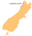
NZ-Karamea B.png 440 × 497; 33 KB
-
NZ-SH 60 map.png 510 × 414; 11 KB
-
NZ-SH 63 map.png 539 × 501; 11 KB
-
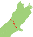
NZ-SH 65 map.png 615 × 570; 13 KB
-
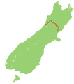
NZ-SH 73 map.png 728 × 813; 17 KB
-
NZ-SH 75 map.png 678 × 567; 11 KB
-
NZ-SH 77 map.png 852 × 735; 17 KB
-
NZ-SH6 map.png 1,234 × 1,395; 79 KB
-
NZ-SH7 map.png 1,234 × 1,395; 57 KB
-
NZ-SH8 map.png 617 × 698; 46 KB
-
NZ-SH82 map.png 968 × 850; 22 KB
-
NZ-SH83 map.png 996 × 886; 23 KB
-
NZ-SH85.png 767 × 770; 19 KB
-
NZ-SH87.png 986 × 860; 19 KB
-
NZ-SH94 map.png 1,091 × 924; 21 KB
-
NZ-SH96 map.png 744 × 661; 13 KB
-
NZ-SH99 map.png 730 × 662; 14 KB
-
NZ-SI plain map.png 1,234 × 1,395; 44 KB
-
NZ-SouthernScenicRoute.png 972 × 876; 20 KB
-
NZ-Tasman B.png 440 × 497; 34 KB
-
NZSouthIsland-ca.png 259 × 309; 34 KB
-
NZSouthIsland.png 259 × 309; 45 KB
-
Picturesque New Zealand, South Island map.jpg 3,303 × 4,795; 1.42 MB
-
South island map.png 1,500 × 1,537; 642 KB
-
South Island New Zealand Rail Map (10469556503).jpg 4,379 × 5,376; 2.12 MB
-
South Island on the globe.png 1,125 × 1,125; 477 KB
-
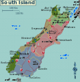
South island regions.svg 1,123 × 1,150; 1.03 MB
-
SouthIsland rrMap v02.svg 744 × 1,000; 70 KB
-
Séisme de septembre 2010 en Nouvelle Zélande.jpg 612 × 708; 94 KB
-
സെക്രട്ടറി ദ്വീപ്.png 440 × 497; 30 KB


