Category:Maps of the Six-Day War
Jump to navigation
Jump to search
| Category Maps of the Six-Day War on sister projects: | |||||||||
|---|---|---|---|---|---|---|---|---|---|
Maps of the Six-Day War. Also known as the 1967 Arab–Israeli War.
Media in category "Maps of the Six-Day War"
The following 62 files are in this category, out of 62 total.
-
 1967 Six Day War - Battle of Golan Heights-es.svg 2,036 × 2,000; 1.01 MB
-
 1967 Six Day War - Battle of Golan Heights-HE.jpg 479 × 796; 94 KB
-
 1967 Six Day War - Battle of Golan Heights.jpg 904 × 884; 109 KB
-
 1967 Six Day War - Battle of Golan Heights.svg 904 × 884; 412 KB
-
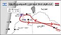
 1967 Six Day War - conquest of Sinai 5-6 June.jpg 740 × 918; 105 KB
-
 1967 Six Day War - conquest of Sinai 7-8 June He.jpg 740 × 918; 504 KB
-
 1967 Six Day War - conquest of Sinai 7-8 June.jpg 740 × 918; 117 KB
-
 1967 Six Day War - The Jordan salient-es.svg 2,036 × 2,000; 988 KB
-
 1967 Six Day War - The Jordan salient.jpg 904 × 890; 109 KB
-
 1967 Six Day War - The Jordan-HE.jpg 565 × 870; 112 KB
-
 6DayWarEnglish.png 4,000 × 6,900; 482 KB
-
 Ammunition Hill Museum Exhibits P1010033.JPG 2,901 × 2,339; 1.33 MB
-
 Ammunition Hill Museum Exhibits P1010034.JPG 4,000 × 3,000; 3.97 MB
-
 Ammunition Hill Museum Exhibits P1010038.JPG 3,780 × 2,000; 1.59 MB
-
 Battle of Golan Heights-hu.svg 2,036 × 2,000; 417 KB
-

-
 EgyptNavyAlexandriaJune1967.jpg 2,252 × 2,936; 1.92 MB
-
 Guèrra dei Sièis Jorns.png 717 × 629; 126 KB
-
 IHM תל פאחר.jpeg 1,382 × 1,071; 595 KB
-
-
 Kuuepäevane sõda.png 400 × 600; 64 KB
-
 Kuwaiti Army In 1967 war (Arabic).jpg 1,006 × 780; 124 KB
-
 LibertyProjectedTrack..jpg 1,342 × 1,020; 437 KB
-
 Map Iof srael after 1967.GIF 357 × 370; 8 KB
-
 Rhyfel chwe diwrnod map.png 398 × 599; 70 KB
-
 Sestodnevni rat.PNG 540 × 592; 45 KB
-
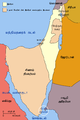
 Six Day War Territories (hy).png 800 × 1,200; 128 KB
-
 Six Day War Territories - Tamil.png 2,000 × 3,000; 261 KB
-
 Six Day War Territories 2.png 398 × 599; 52 KB
-
 Six Day War Territories af.svg 800 × 1,200; 50 KB
-
 Six Day War Territories mk.svg 800 × 1,200; 44 KB
-
 Six Day War Territories ru.svg 800 × 1,200; 41 KB
-
 Six Day War Territories-ar.svg 800 × 1,200; 43 KB
-
 Six Day War Territories-de.svg 800 × 1,200; 43 KB
-
 Six Day War Territories-es.svg 800 × 1,200; 204 KB
-
 Six Day War Territories-fr.png 442 × 666; 75 KB
-
 Six Day War Territories-hu.svg 800 × 1,200; 88 KB
-
 Six Day War Territories-pl.svg 800 × 1,200; 50 KB
-
 Six Day War Territories-pt.svg 800 × 1,200; 54 KB
-
 Six Day War Territories.png 398 × 599; 53 KB
-
 Six Day War Territories.svg 800 × 1,200; 61 KB
-
 Six-Day War Map he.svg 884 × 1,226; 2.2 MB
-
 TaninTorpedodepthCharged.jpg 4,407 × 3,460; 3.22 MB
-
 TelFaher Tablet3.jpg 1,500 × 503; 155 KB
-
 TelFaher Tablet4.jpg 1,500 × 517; 161 KB
-
 TelFaher Tablet5.jpg 1,500 × 488; 143 KB
-
 TelFaher Tablet6.jpg 1,500 × 462; 135 KB
-
 TelFaher Tablet7.jpg 1,500 × 500; 125 KB
-
 Uعملية البرق العراقية .png 1,406 × 804; 1.65 MB
-
 الرواية الإسرائيلية الثانية حول مسار القاصفة الأولى في عملية البرق العراقية.jpg 1,280 × 565; 108 KB
-
 الرواية الإسرائيلية الرابعة حول مسار القاصفة الثانية في عملية البرق العراقية.jpg 1,280 × 557; 115 KB
-
 القاصفة الاولى عملية البرق .png 1,712 × 807; 2 MB
-
 القاصفة الثانية عملية البرق .png 1,712 × 807; 2.02 MB
-
 حرب حزيران 1967.png 1,406 × 804; 1.77 MB
-
 قصف القاصفة الاولى حسب الرواية العراقية في عملية البرق العراقية.jpg 1,280 × 732; 94 KB
-
 مسار القاصفة الاولى حسب الرواية العراقية في عملية البرق العراقية.jpg 1,280 × 642; 98 KB
-

-
 مسار القاصفة الثانية حسب الرواية الإسرائيلية الثامنة في عملية البرق العراقية.jpg 1,280 × 556; 103 KB
-
 مسار القاصفة الثانية حسب الرواية الإسرائيلية الخامسة في عملية البرق العراقية.jpg 1,280 × 557; 101 KB
-
 مسار القاصفة الثانية حسب الرواية الإسرائيلية السابعة في عملية البرق العراقية.jpg 1,280 × 556; 104 KB
-
 مسار القاصفة الثانية حسب الرواية الإسرائيلية السادسة في عملية البرق العراقية.jpg 1,280 × 556; 109 KB
-
 مسار القاصفة الثانية لضرب قاعدة رمات ديفيد الجوية قاعدة رامات ديفيد الجوية.jpg 1,280 × 637; 116 KB


.jpg)


.png)


