Category:Maps of the Siege of Paris, 1870-1871
Jump to navigation
Jump to search
Media in category "Maps of the Siege of Paris, 1870-1871"
The following 20 files are in this category, out of 20 total.
-

-

-

-

-

-

-
 497 of 'Die Hohenzollern und das Reich, etc' (11169422356).jpg 2,528 × 1,654; 1.53 MB
-

-
 732 of 'Cassell's History of the War between France and Germany' (11226741033).jpg 2,864 × 1,962; 1.45 MB
-
 Commune de Paris 1871 - Second siège de Paris 2 avril au 21 mai 1871 - Gallica.jpg 9,307 × 8,222; 12.36 MB
-
 Defense of Paris - Cornell University Library.tif 3,747 × 4,825; 51.75 MB
-
 Defense of Paris, October 1870 - Cornell University Library.tif 2,959 × 3,989; 33.79 MB
-
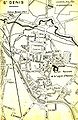
 Investissement de Paris 1er septembre 1870(18 btv1b8444518t 1).jpg 1,257 × 1,054; 397 KB
-
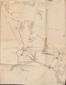
 Opérations militaires.jpg 1,138 × 827; 759 KB
-
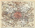
 Paris and its environs, showing the fortifications.png 3,537 × 2,598; 14.36 MB
-
 Paris Petite Ceinture 1898.jpg 2,524 × 2,041; 1.27 MB
-
 Paris und Umgebung 1871, Saint-Denis cropped brightness.png 619 × 601; 706 KB
-
 Paris, Western division.png 2,586 × 3,395; 14.58 MB
-
 Saint-Denis -Plan de livreur-.JPG 1,072 × 1,656; 454 KB
-
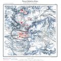 Schlacht bei Villiers.jpg 1,600 × 1,600; 882 KB
.jpg)
.jpg)
.jpg)
.jpg)
%27_(11254070624).jpg)
.jpg)
.jpg)
.jpg)
.jpg)

.jpg)


