
Category:Maps of the Second Mexican Empire
Media in category "Maps of the Second Mexican Empire"
The following 22 files are in this category, out of 22 total.
-
 2 Imperio Mexico 1865.PNG 1,319 × 834; 71 KB
-
 Batalla Jahuactal.jpg 2,501 × 1,565; 663 KB
-
 Bombardement d'Acapulco (Méxique).jpg 626 × 425; 128 KB
-
 Carte du theatre de la guerre au Mexique.jpg 475 × 348; 93 KB
-
 División territorial Segundo Imperio Mexicano.svg 975 × 653; 656 KB
-
 Expédition du Mexique. — Plan du combat de Borrego.jpg 1,162 × 855; 321 KB
-
 Expédition française au Mexique es.svg 1,463 × 1,207; 516 KB
-
 Expédition française au Mexique.svg 1,463 × 1,204; 298 KB
-
 Mapa de Mexico 1865.PNG 1,669 × 1,518; 108 KB
-
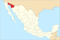
 Mexican Empire Map.png 267 × 257; 7 KB
-
 Mexico 1865 Aguascalientes locator map.svg 512 × 344; 192 KB
-
 Political divisions of Mexico 1865 (location map scheme).svg 649 × 617; 330 KB
-
 Political divisions of Mexico 1865 (numbers).svg 1,440 × 964; 414 KB
-
 Political divisions of Mexico 1865.svg 1,440 × 964; 289 KB
-
 Second French Intervention.png 1,463 × 1,194; 269 KB
-
 Second Mexican Empire (equirectangular projection).png 1,500 × 1,117; 633 KB
-
 Second Mexican Empire (orthographic projection).svg 541 × 541; 424 KB
-
 Second Mexican Empire Arizona.png 1,440 × 964; 205 KB
-
 Second Mexican Empire California.png 1,440 × 964; 204 KB
-
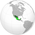
 Second Mexican Empire on the globe.svg 792 × 792; 1.86 MB
-
 Second Mexican Empire Territory Controlled.png 1,024 × 1,024; 251 KB
-
 Франко-мексиканская война.svg 1,060 × 900; 62 KB


.jpg)


.svg)
.svg)


.png)
.svg)


