Category:Maps of the Santa Cruz islands
Jump to navigation
Jump to search
Media in category "Maps of the Santa Cruz islands"
The following 11 files are in this category, out of 11 total.
-
 Durville-Vanikoro-plan.jpg 7,120 × 5,552; 4.2 MB
-
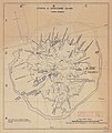 Utupua or Edgecumbe Island 1968 62.5K map.jpg 4,049 × 4,803; 4.84 MB
-
 Admiralty Chart Catalogue 1967 Page 083 Index N1.jpg 8,573 × 6,867; 6.9 MB
-
 Admiralty Chart No 17 South West Pacific Santa Cruz Is., Published 1870.jpg 5,936 × 7,959; 11.83 MB
-
 Duff Islands map 1797 (retouched).jpg 3,160 × 2,045; 3.35 MB
-
 Duff Islands map 1797.jpg 3,467 × 2,373; 480 KB
-
 Karta SB SantaCruz isl.PNG 300 × 200; 4 KB
-
 Map of the Santa Cruz Islands (Solomon Islands).png 2,449 × 1,368; 175 KB
-
 OSM 2023 Solomons Temotu.png 1,894 × 2,390; 443 KB
-
 Solomon Islands - Santa Cruz Islands.PNG 932 × 565; 62 KB
-
 Tapoua Utupua 1876 map.jpg 1,343 × 1,266; 173 KB


.jpg)


.png)


