Category:Maps of the Salton Sea
Jump to navigation
Jump to search
Media in category "Maps of the Salton Sea"
The following 9 files are in this category, out of 9 total.
-
Saltonseadrainagemap.jpg 782 × 735; 278 KB
-
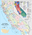
California tribes & languages at contact.png 5,304 × 5,853; 3.53 MB
-
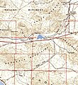
Eagle Mountain Railroad.jpg 591 × 647; 224 KB
-
Map of Distribution of Indian Tribes in California by JW Powell 1877.jpg 4,691 × 5,482; 8.01 MB
-
USGS Map-Chocolate Mountain Aerial Gunnery Range.png 1,157 × 901; 1.61 MB
-
Whitewaterrivermap.jpg 782 × 735; 277 KB
-
Newriverwatershed-1-.jpg 1,415 × 1,826; 511 KB


