Category:Maps of the Saint Lawrence River
Jump to navigation
Jump to search
English: Maps of the Saint Lawrence River, along the border between the United States and Canada
See also category: Maps of the Saint Lawrence River Basin.
Subcategories
This category has the following 2 subcategories, out of 2 total.
M
- Maps of the Thousand Islands (9 F)
Media in category "Maps of the Saint Lawrence River"
The following 9 files are in this category, out of 9 total.
-
-

-

-
 Admiralty Chart Catalogue 1967 Page 115 Index U.jpg 8,572 × 6,820; 8.58 MB
-
 Cartier Second Voyage Map 1 fr.png 831 × 567; 91 KB
-
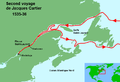
 Cartier Second Voyage Map 1.png 831 × 567; 103 KB
-

-
 Saint Lawrence map-fi.png 3,425 × 2,375; 5.55 MB
-
 ÎleDOrléans2022OSM.png 5,325 × 3,598; 5.85 MB
_hung_on_a_horn%27_(11211564646).jpg)
_hung_on_a_horn%27_(11208682986).jpg)
%27_(11225703654).jpg)


_(14784054013).jpg)

