Category:Maps of the Rif region
Jump to navigation
Jump to search
Subcategories
This category has only the following subcategory.
L
- Locator maps of the Rif region (11 F)
Media in category "Maps of the Rif region"
The following 23 files are in this category, out of 23 total.
-
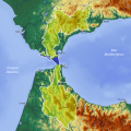
 Rif carta fisica.jpg 636 × 275; 23 KB
-
 Atlasgebergte.jpg 953 × 517; 129 KB
-
 Atlas (Rotulado español).png 3,261 × 2,025; 11.2 MB
-
 Atlas-Mountains-Labeled-2 new.jpg 1,095 × 925; 260 KB
-
 Atlas-Mountains-Labeled-2.jpg 3,755 × 1,884; 1.25 MB
-
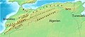 Atlasgebirge topografisch politsch mittel mit Hochland.jpg 636 × 275; 65 KB
-
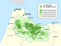 Cannabis en Marruecos 2003.svg 512 × 381; 253 KB
-
 Carte des tribus du Rif.PNG 407 × 347; 15 KB
-

-

-
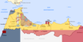
 Le Rif au nord du Maroc (sous colonisation espagnole de 1912 à 1956).png 800 × 340; 160 KB
-
 Le territoire du Rif au nord du Maroc.png 800 × 340; 162 KB
-
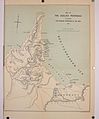 Map of the Guelaia Peninsula (1909).jpg 2,277 × 2,747; 499 KB
-
-
 Reserva de la biosfera intercontinental del Mediterráneo.svg 997 × 997; 3.1 MB
-
 Rif mountains.png 766 × 479; 586 KB
-
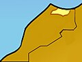
 Rif region.png 800 × 409; 46 KB
-
 Riffijnen.jpeg 155 × 117; 26 KB
-
 Région du Rif au nord du Maroc (Ancien protectorat espagnol de 1912 à 1956).png 1,418 × 538; 465 KB
-
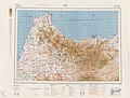 Series 1404 sheet 420-B Fes, published 1962.jpg 7,733 × 5,851; 10.86 MB
-
 Tarifit.jpg 770 × 374; 27 KB
-

-
 Territoire du Rif au nord du Maroc (ancien Rif espagnol).png 1,280 × 655; 141 KB


.png)


_combatido_por_Mohamed_El-Khattabi_y_las_tribus_del_Rif).png)
.png)

.jpg)
_de_1912_%C3%A0_1956_et_protectorat_fran%C3%A7ais_dans_le_reste_du_Maroc_(sauf_sahara)_de_1912_%C3%A0_1956.png)


_au_nord_du_Maroc.png)
.png)
.png)
.png)