Category:Maps of the Republic of the United States of Indonesia
Jump to navigation
Jump to search
Subcategories
This category has only the following subcategory.
Media in category "Maps of the Republic of the United States of Indonesia"
The following 15 files are in this category, out of 15 total.
-
 Indonesia Rebublic provinces map-de.svg 1,322 × 620; 421 KB
-
 Indonesia Rebublic provinces map-fr.svg 1,322 × 620; 420 KB
-
 IndonesianGreatEast.jpg 759 × 484; 99 KB
-
 LinggadjatiPlan.jpg 1,322 × 620; 136 KB
-
 Map of the United States of Indonesia-es.svg 786 × 361; 877 KB
-
 Map of the United States of Indonesia-id.svg 786 × 361; 890 KB
-
 Map of the United States of Indonesia.svg 786 × 361; 872 KB
-
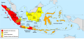
 Republik Indonesia Serikat BI.PNG 1,323 × 622; 226 KB
-
 Republik Indonesia Serikat.png 1,323 × 622; 208 KB
-
 State of East Sumatra.jpg 777 × 613; 113 KB
-
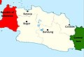 State of Pasundan.jpg 1,388 × 945; 161 KB
-
 State of Pasundan.svg 151 × 81; 366 KB
-
 StateofEastIndonesia.jpg 623 × 484; 101 KB
-
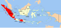
 United States of Indonesia Map - English.jpg 2,000 × 915; 921 KB
-
 Van Mook.png 740 × 235; 47 KB


