Category:Maps of the Republic of Ragusa
Jump to navigation
Jump to search
Media in category "Maps of the Republic of Ragusa"
The following 27 files are in this category, out of 27 total.
-
AdriáticoVenecianoSigloXV.svg 5,144 × 1,464; 1.62 MB
-
Atlante Veneto Volume 2 052.jpg 10,318 × 7,010; 8.74 MB
-
Bosanski pašaluk 1600. godine.png 2,250 × 1,536; 1.27 MB
-
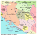
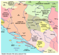
Bosnia around 1412-es.svg 1,896 × 1,655; 862 KB
-
Bosnia around 1412-sh.png 884 × 826; 113 KB
-
Bosnia around 1412-sr.png 884 × 826; 110 KB
-
Bosnia around 1412.png 884 × 826; 113 KB
-
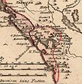
Cattaro Ragusa von Reilly 1789.jpg 640 × 649; 238 KB
-
Dubrovacka republika-sr.png 768 × 428; 41 KB
-
Dubrovacka republika.png 768 × 428; 41 KB
-
Dubrovacka republika01.png 768 × 428; 30 KB
-
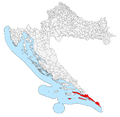
Dubrovnik Republic in Croatia.png 2,201 × 2,151; 245 KB
-
Eastern Adriatic 1558.svg 1,920 × 1,753; 6.84 MB
-
Kingdom of Croatia 1469.png 2,230 × 1,944; 372 KB
-
La Serbie en fin de regne de Lazar.jpg 540 × 600; 271 KB
-
Map of Ragusa.jpg 378 × 311; 109 KB
-
Map of the Republic of Ragusa.png 1,023 × 907; 174 KB
-
Ragusa hr.png 675 × 354; 112 KB
-
Ragusa-IT.png 675 × 354; 120 KB
-
Ragusa-RU.png 675 × 354; 118 KB
-
Ragusa.png 675 × 354; 128 KB
-
Reino de Serbia del kniaz Lazar.jpg 540 × 600; 126 KB
-
Republic of Ragusa.svg 512 × 519; 1.09 MB
-
Territory of the Republic of Ragusa early 18th century.png 1,241 × 968; 2.56 MB
-
The Republic of Ragusa in the mid-18th century.jpg 2,816 × 2,112; 2.1 MB
-
Vistaderagusa1667.jpg 827 × 669; 250 KB
-
Zadar Treaty 1358.png 2,230 × 1,944; 379 KB


