Category:Maps of the Republic of Novgorod
Jump to navigation
Jump to search
Media in category "Maps of the Republic of Novgorod"
The following 33 files are in this category, out of 33 total.
-
 Bjarmaland,Carta Marina.jpg 883 × 1,090; 472 KB
-
 Europe-1139 (Zaleskie).jpg 618 × 436; 39 KB
-
 I. Карта погостов Шелонской пятины.png 6,201 × 4,757; 322 KB
-
 II. Карта погостов Шелонской пятины.png 4,691 × 6,142; 364 KB
-
 III. Карта погостов Шелонской пятины.png 6,104 × 4,672; 267 KB
-
 IV. Карта погостов Шелонской пятины.png 6,120 × 4,732; 355 KB
-
 IX. Карта погостов Шелонской пятины.png 6,245 × 9,391; 682 KB
-
 Kievan Rus in 1237 (en).svg 1,204 × 1,306; 332 KB
-
 Kievan Rus in 1237 (PL).svg 1,200 × 1,302; 235 KB
-
 Kievan Rus in 1237 (ru).svg 1,200 × 1,302; 342 KB
-
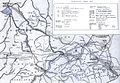 Lipits karta srazheniya.jpg 1,452 × 1,007; 284 KB
-
 North-Eastern Rus principalities - 13th century-es.svg 590 × 945; 910 KB
-
 North-Eastern Rus principalities - 13th century.svg 590 × 945; 4.18 MB
-
 North-Eastern Rus principalities - 14th century-es.svg 604 × 899; 915 KB
-
 North-Eastern Rus principalities - 14th century.svg 604 × 899; 1.68 MB
-
 Novgorod Alexander Nevsky EL.JPG 774 × 603; 69 KB
-
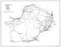
 Novgorod Pyatiny.jpg 2,609 × 4,369; 10.75 MB
-
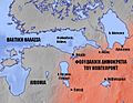
 Novgorod Republic in 1237 en.png 811 × 698; 292 KB
-
 Novgorod1400.png 900 × 560; 24 KB
-
 Principality of Smolensk 1237.png 1,069 × 691; 385 KB
-
 Principality of Vladimir-Suzdal in 1237 (en).png 691 × 612; 216 KB
-
 Pskov Republic 1389.png 1,405 × 1,100; 58 KB
-
 Pskov Republic 1444.jpg 983 × 790; 138 KB
-
 R F N 2.PNG 151 × 131; 2 KB
-
 Rus de Kiev en 1237.gif 1,200 × 1,302; 137 KB
-
 Rus de Kiev en 1237.png 1,200 × 1,302; 342 KB
-
 Rus de Kiev es 1237.svg 1,200 × 1,302; 911 KB
-
 Rus-1015-1113.png 2,202 × 2,698; 1.76 MB
-
 Rus-1113-1194.png 2,193 × 2,686; 557 KB
-
 Rus-1240-nevski.png 1,399 × 1,163; 85 KB
-
 Rus-1389.png 3,548 × 2,609; 258 KB
-
 Russian lands to 1250.jpg 2,401 × 2,018; 813 KB
-
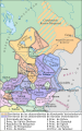
 Владимиро-Суздальское княжество.png 1,440 × 1,439; 851 KB

.jpg)


.svg)
.svg)
.svg)


.png)


