Category:Maps of the Regional Municipality of Peel
Jump to navigation
Jump to search
Subcategories
This category has the following 5 subcategories, out of 5 total.
Media in category "Maps of the Regional Municipality of Peel"
The following 11 files are in this category, out of 11 total.
-
Brampton and Mississauga Map Ontario.jpg 500 × 597; 137 KB
-
County of Peel, Ontario, Canada map (1937).jpg 1,301 × 1,516; 286 KB
-
Gore of Toronto Township, Peel County, Ontario, 1880.jpg 4,352 × 2,015; 3.43 MB
-
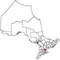
Map of Ontario PEEL.svg 340 × 330; 84 KB
-
North Chinguacousy Township, Peel County, Ontario, 1880.jpg 4,041 × 3,102; 12.25 MB
-
Ontpel.png 378 × 379; 4 KB
-
Peel county.png 400 × 757; 8 KB
-
Region Peel Ontario.png 835 × 864; 27 KB
-
South Chinguacousy Township, Peel County, Ontario, 1880.jpg 4,232 × 3,248; 6.21 MB
-
Townships of Peel County, Ontario, 1880..jpg 401 × 773; 224 KB
-
Watercourses of Albion Township, Peel County, Ontario, 1880.jpg 2,663 × 4,249; 5.58 MB


