Category:Maps of the Raritan River
Jump to navigation
Jump to search
Media in category "Maps of the Raritan River"
The following 11 files are in this category, out of 11 total.
-
 A map of Rariton River, Milstone River, South River ... (1685) LOC 97683564.jpg 8,368 × 7,152; 6.7 MB
-
 A map of Rariton River, Milstone River, South River ... (1685) LOC 97683564.tif 8,368 × 7,152; 171.23 MB
-

-
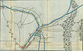
 BB Flood Control.jpg 755 × 536; 136 KB
-
 Ewald BoundBrook 1777.jpg 3,000 × 1,844; 1.02 MB
-
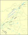 GreenBrookMap.png 888 × 1,102; 98 KB
-

-

-
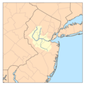 Raritanrivermap.png 300 × 300; 17 KB
-
 T11-1.jpg 11,343 × 7,867; 4.52 MB
-
 T11-2.jpg 7,724 × 11,104; 3.18 MB
_LOC_97683564.jpg)


_(NYPL_b15367112-433625).jpg)


