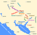
Category:Maps of the Principality of Zeta in the 15th century
Jump to navigation
Jump to search
Subcategories
This category has the following 2 subcategories, out of 2 total.
M
- Maps of Zeta (Crnojević) (17 F)
Media in category "Maps of the Principality of Zeta in the 15th century"
The following 11 files are in this category, out of 11 total.
-
Balsa III Balsic 1421 eng.svg 1,461 × 1,115; 662 KB
-
Balsa III Balsic 1421 es.svg 1,461 × 1,091; 580 KB
-
Bar Ulcinj Skadar i Drivast 1392 - 1421 B.svg 922 × 1,127; 951 KB
-
Budva 1392 - 1420.svg 1,213 × 852; 874 KB
-
Dio katuna Gornje Zete sredinom XV vijeka cir.png 1,218 × 1,516; 242 KB
-
Dio katuna Gornje Zete sredinom XV vijeka.svg 913 × 858; 295 KB
-
Drugi skadarski rat - pocetak 1419-1420.svg 1,289 × 1,024; 620 KB
-
Drzava Crnojevica.JPG 871 × 1,064; 99 KB
-
Prodor turaka u crnu goru XV c BC b.png 839 × 1,223; 245 KB
-
Stanje nakon Prvog skadarskog rata 1412 g.svg 1,281 × 895; 451 KB
-
Upper and Lower Zeta in 15th c engl.svg 1,600 × 1,200; 199 KB


