Category:Maps of the Principality of Pannonian Croatia
Jump to navigation
Jump to search
Media in category "Maps of the Principality of Pannonian Croatia"
The following 8 files are in this category, out of 8 total.
-
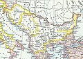 Balkans in 9th century.jpg 1,195 × 847; 339 KB
-
 Balkans in the 9th century.png 635 × 322; 392 KB
-
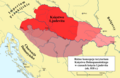
 Karte Mährerreich Mojmír I.png 1,126 × 994; 1.14 MB
-
 Ksiestwo Dolnopanonskie w czasach Ljudevita.png 2,000 × 1,308; 437 KB
-
 Ksiestwo-dolnopanonskie-ljudvit.png 3,553 × 2,323; 916 KB
-
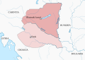 Territory governed by Braslav-es.svg 601 × 424; 305 KB
-
 Territory governed by Braslav-hu.svg 601 × 424; 261 KB
-
 Territory governed by Braslav.png 736 × 518; 66 KB


