Category:Maps of the Prince-Bishopric of Eichstätt
Jump to navigation
Jump to search
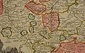
English: Maps showing the Prince-Bishopric of Eichstätt, made of several non-contiguous parts. The prince-bishopric ceased to exist in 1803.
Deutsch: Landkarten des Hochstifts Eichstätt, das aus mehreren nicht-zusammenhängen Gebieten bestand und bis 1803 existierte.
Media in category "Maps of the Prince-Bishopric of Eichstätt"
The following 7 files are in this category, out of 7 total.
-
 Eichstätt Le Rouge 1757.jpg 1,988 × 1,500; 1.27 MB
-
 Karte der ungefähren Lage des Hochstifts Eichstätt.jpg 1,997 × 1,315; 2.85 MB
-
 Prince-Bishopric of Eichstätt.jpg 1,755 × 1,500; 626 KB
-
 Principatus et Episcopatus Eistettensis Detail 1.jpg 653 × 780; 225 KB
-
 Principatus et Episcopatus Eistettensis Detail 2.jpg 1,191 × 780; 328 KB
-
 Principatus et Episcopatus Eistettensis Detail 3.jpg 1,226 × 780; 405 KB
-
 S.R.I. Principatus et episcopatus Eistettensis - CBT 5878319.jpg 4,657 × 4,220; 5.31 MB


