Category:Maps of the Poles
Jump to navigation
Jump to search
Subcategories
This category has the following 3 subcategories, out of 3 total.
B
- Maps of the Poles in Belarus (18 F)
L
Media in category "Maps of the Poles"
The following 19 files are in this category, out of 19 total.
-
Poles out of Poland map 2008.png 1,819 × 828; 232 KB
-
AGAD Mapa Galicji – Projekt sejmowych okręgów wyborczych – Kurya wiejska.png 2,592 × 1,944; 7.5 MB
-
Americans with Polish Ancestry by state.svg 959 × 593; 75 KB
-
Countries with most Poles.png 6,421 × 3,326; 1.58 MB
-
DistributionOfPolesInCentralEurope.png 1,304 × 1,600; 371 KB
-
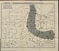
Kart425(0037).jpg 4,000 × 3,100; 1.69 MB
-
Minorités polonaises - Europe centrale.png 586 × 543; 75 KB
-
Narodowości b WKL 1921.jpg 2,075 × 1,534; 524 KB
-
Polacy na Zaolziu 2011.png 1,865 × 2,317; 438 KB
-
Polacy na Zaolziu 2021.png 1,865 × 2,317; 424 KB
-
Polacy na Zaolziu.png 1,865 × 2,317; 446 KB
-
Polacy w Berlinie.png 2,592 × 2,389; 412 KB
-
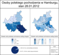
Polacy w Hamburgu.png 2,592 × 2,389; 864 KB
-
Polen BV042512252.jpg 5,047 × 4,393; 2.25 MB
-
Poles1959ua.PNG 567 × 449; 37 KB
-
Polish minority in Ukraine 2001.PNG 1,117 × 765; 47 KB
-
Polonezi Romania (2002).png 1,601 × 1,027; 207 KB
-
Vilnia, Biełarusy. Вільня, Беларусы (1923).jpg 918 × 1,077; 253 KB


