Category:Maps of the Oyo Empire
Jump to navigation
Jump to search
Media in category "Maps of the Oyo Empire"
The following 6 files are in this category, out of 6 total.
-
 Oyo Empire at Its Greatest Extent, c. 1780 (5).jpg 2,674 × 3,492; 1.63 MB
-
 Oyo Empire at Its Greatest Extent, c. 1780.jpg 3,331 × 4,394; 6.22 MB
-
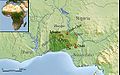
 OyoEmpireExtent.png 746 × 456; 47 KB
-
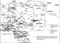
 Oyoxviii.jpeg 545 × 341; 156 KB
-
 The States of the Nigerian Region in the 16th century.png 2,066 × 1,638; 521 KB
-
 The States of the Nigerian Region in the 19th Century.png 2,258 × 1,640; 636 KB
.jpg)


