Category:Maps of the Ottoman Empire in the 17th century
Jump to navigation
Jump to search
English: This category is about history maps on the subject. Old maps belong into: Category:17th-century maps of the Ottoman Empire and its subcategories.
Subcategories
This category has the following 3 subcategories, out of 3 total.
Media in category "Maps of the Ottoman Empire in the 17th century"
The following 38 files are in this category, out of 38 total.
-
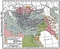
 Impero Ottomano ai tempi dell'Impresa di Bona.jpg 2,195 × 1,646; 329 KB
-
 Ottoman empire 1481-1683.jpg 1,636 × 1,321; 458 KB
-
 Ottoman empire.svg 900 × 750; 2.45 MB
-
 Ottoman map comparison 1590 and 1683.png 1,920 × 1,080; 134 KB
-
 OttomanEmpire (Turkish).png 1,920 × 1,378; 686 KB
-
 Empèri Otoman - Expansion territòriala de 1307 a 1683.png 1,652 × 1,170; 778 KB
-
 Great serb migration-es.svg 8,584 × 7,087; 300 KB
-
 Great serb migration-pt.svg 8,584 × 7,087; 143 KB
-
 Great serb migration-sr.png 1,601 × 1,534; 123 KB
-
 Great serb migration.png 1,601 × 1,534; 150 KB
-
 ImperioOtomano.svg 2,433 × 2,000; 2.58 MB
-
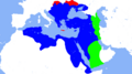
 ImperioOtomanoSimplificado-ar.svg 912 × 750; 901 KB
-
 ImperioOtomanoSimplificado-en.svg 912 × 750; 1,006 KB
-
 ImperioOtomanoSimplificado-pt.svg 912 × 750; 753 KB
-
 ImperioOtomanoSimplificado.svg 912 × 750; 2.27 MB
-
 Ottoman Empire 1500-1700.jpg 960 × 1,057; 448 KB
-
 Ottoman Empire 16-17th century-ar.jpg 800 × 585; 160 KB
-
 Ottoman Empire 16-17th century-fr.svg 800 × 585; 978 KB
-
 Ottoman Empire 16-17th century-hu.svg 800 × 585; 945 KB
-
 Ottoman Empire 16-17th century-pt.svg 800 × 585; 944 KB
-
 Ottoman Empire 16-17th century.jpg 800 × 585; 213 KB
-
 Ottoman empire de.svg 900 × 750; 1.12 MB
-
 Ottoman empire He.svg 900 × 750; 1.44 MB
-
 Ottoman empire hu.png 2,500 × 2,083; 1.84 MB
-
 OttomanEmpire1622.png 3,597 × 2,580; 1.18 MB
-
 OttomanEmpire1699-ar.png 3,594 × 2,580; 1.39 MB
-
 OttomanEmpire1699.png 3,594 × 2,580; 1.18 MB
-
 OttomanEmpireMain (Turkish).png 1,920 × 1,378; 865 KB
-
 OttomanNorth.png 1,157 × 720; 159 KB
-
 Regency of Algiers 15th-18th Century.jpg 2,250 × 1,974; 1.34 MB
-
 Régence d'Alger 1700 map-es.svg 1,220 × 610; 276 KB
-
 Régence d'Alger 1700 map-fr.svg 1,220 × 610; 271 KB
-
 Régence d'Alger 1700 map-pt.svg 1,220 × 610; 275 KB
-
 Territorial changes of the Ottoman Empire 1672.jpg 1,104 × 834; 429 KB
-
 Territorial changes of the Ottoman Empire 1699.jpg 1,104 × 834; 442 KB
-
-
 Uyvar eyalet.png 740 × 781; 40 KB
-
 الصراع بين العثمانيين والصفويين.jpg 1,370 × 958; 422 KB


.png)


.png)


