Category:Maps of the Odenwald
Jump to navigation
Jump to search
Subcategories
This category has the following 2 subcategories, out of 2 total.
Media in category "Maps of the Odenwald"
The following 26 files are in this category, out of 26 total.
-
Karte von Odenwald, Bergstraße und Riedgebiet zwischen Darmstadt und Heidelberg.jpg 8,080 × 5,771; 46.9 MB
-
Abgeleitete Karte von Bayern (Odenwald).jpg 2,600 × 2,345; 1.76 MB
-
Erpach Comitatus.jpg 6,825 × 5,294; 9.61 MB
-
FRANKENSTEIN KOMPLEX 2.jpg 1,308 × 1,588; 1.3 MB
-
Gemarkung Höchst 1753.jpg 1,167 × 1,598; 1.73 MB
-
Infotafel Hirschburg.jpg 2,016 × 1,953; 1.68 MB
-
Infotafel Schanzenköpfle.jpg 2,010 × 2,580; 3.66 MB
-
Karte Kleiner Odenwald.png 1,000 × 728; 462 KB
-
Karte Kleiner Odenwald.svg 1,000 × 728; 66 KB
-
Kleiner-odenwald.jpg 1,000 × 750; 117 KB
-
Landkarte Böllsteiner O 2.jpg 964 × 1,832; 1.1 MB
-
Location Odenwald.PNG 506 × 439; 40 KB
-
Map of Bavaria North East 1600.jpg 800 × 600; 168 KB
-
Map of Swabia, Bavaria, Odenwald NW 1600.jpg 800 × 600; 159 KB
-
Odenwald (Grimm) K 001.jpg 6,579 × 8,673; 15.38 MB
-
Odenwald - Deutsche Mittelgebirge, Serie A-de.png 1,800 × 1,650; 4.36 MB
-
Odenwald bergbaupsd.jpg 2,000 × 2,347; 4.75 MB
-
Odenwald Böllsteiner Odenwald.PNG 324 × 295; 223 KB
-
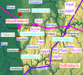
Odenwald Dialekte 2.PNG 324 × 295; 193 KB
-
Odenwald Frankensteinkomplex.PNG 324 × 295; 222 KB
-
Odenwald topo.jpg 453 × 339; 91 KB
-
Odenwald.png 188 × 235; 7 KB
-
Special Karte von dem Odenwald, dem Bauland und einem Theil des Spessart's.jpg 7,259 × 5,802; 11.56 MB
-
Übersichtskarte Odenwald.png 414 × 377; 270 KB


