Category:Maps of the Northwestern United States
Jump to navigation
Jump to search
Media in category "Maps of the Northwestern United States"
The following 23 files are in this category, out of 23 total.
-
 Nearctic-Northwestern United States.svg 1,789 × 2,154; 378 KB
-
 Nearctic-Ecozone-Northwestern United States.svg 452 × 433; 25 KB
-
 1872 North Cascades Isoseismal Map.png 1,464 × 1,544; 508 KB
-
 Columbiarivermap.png 1,500 × 1,500; 3.6 MB
-
 EPA WA-OR-ID snowpack map w text.png 633 × 863; 589 KB
-
 EPA WA-OR-ID snowpack map.png 603 × 744; 524 KB
-
 Inland Northwest United States.svg 280 × 280; 383 KB
-
 Inland Northwest.svg 991 × 1,056; 464 KB
-
 LLWS Northwest.svg 959 × 593; 105 KB
-
 Map-USA-Pacific Northwest01-LiS2.png 848 × 1,037; 88 KB
-
 Map-USA-Pacific Northwest01.png 848 × 1,037; 149 KB
-
 Map-USA-Pacific Northwest01.svg 744 × 1,052; 274 KB
-
 Northwest Power and Conservation Council members.svg 959 × 593; 32 KB
-
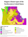 Northwestern US Köppen.png 6,000 × 7,919; 679 KB
-
 PacificNW volcanics.png 449 × 637; 25 KB
-
 Rogue River-Siskiyou National Forest map.pdf 2,550 × 1,650; 30.35 MB
-
 The Columbia River Its History, Its Myths, Its Scenery, Its Commerce p 595.png 1,775 × 945; 2.59 MB
-
 The story of Montana (1916) (14771716244).jpg 3,152 × 2,276; 878 KB
-
 US map-Northwest.PNG 572 × 371; 17 KB
-
 US Northwest Temples Outline Map.svg 671 × 703; 17 KB
-
 Voyage de La Pérouse autour du monde (No. 16) BHL15849654.jpg 6,832 × 9,696; 3.69 MB
-
 Wyoming regions map.png 2,000 × 1,562; 855 KB
-
 Wyoming regions map.svg 744 × 1,052; 7.68 MB


_(14771716244).jpg)


_BHL15849654.jpg)

