Category:Maps of the Northwest Indian War
Jump to navigation
Jump to search
Media in category "Maps of the Northwest Indian War"
The following 18 files are in this category, out of 18 total.
-
Fallen Timbers Battlefield - Lossing.jpg 2,988 × 5,312; 4.4 MB
-
Fort Wayne 1795.jpg 512 × 809; 57 KB
-
Glaize.png 8,769 × 6,063; 1.38 MB
-
Greenville Treaty line Corner P4020194.JPG 3,072 × 2,304; 1.16 MB
-
Greenville Treaty Line Map.png 544 × 711; 79 KB
-
Gville Treaty Line marker.jpg 3,264 × 2,448; 3.46 MB
-
Gville Treaty Line sign.jpg 3,264 × 2,448; 3.62 MB
-
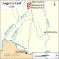
Logans Raid.png 3,083 × 3,083; 612 KB
-
Map of Kekionga.jpg 734 × 571; 80 KB
-
Map of St. Clair's Encampment.jpg 3,880 × 2,168; 4.13 MB
-
Map of the northern parts of the United States of America (1804).jpg 5,530 × 3,888; 5.34 MB
-
Michigan historical collections (1892) (14595543059).jpg 2,658 × 4,248; 1.13 MB
-
NW Native Tribes, 1792.png 884 × 860; 153 KB
-
Ohio Country de.png 1,217 × 920; 1.42 MB
-
Ohio Country en.png 1,217 × 920; 1.41 MB
-
Seneca Nation territory 1794.tif 2,525 × 1,849; 77 KB


