Category:Maps of the North Sea flood of 1953
Jump to navigation
Jump to search
Media in category "Maps of the North Sea flood of 1953"
The following 7 files are in this category, out of 7 total.
-
 Belgien1953.png 700 × 615; 187 KB
-
 Flooding.png 336 × 450; 98 KB
-
 Hollandsturmflut.png 1,318 × 871; 334 KB
-
 North Sea flood of 1953.png 1,318 × 871; 248 KB
-
 Overstromingsgebied nederland 1953.png 1,000 × 660; 205 KB
-
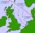 StormTrack.png 487 × 472; 58 KB
-
 Watersnood van 1953.png 1,318 × 871; 335 KB


