Category:Maps of the Nieuwe Waterweg
Jump to navigation
Jump to search
Media in category "Maps of the Nieuwe Waterweg"
The following 24 files are in this category, out of 24 total.
-
 Beneeden rivier de Maas.jpg 1,001 × 531; 179 KB
-
 Diepte Waterweg.jpg 1,337 × 414; 50 KB
-
 Dutch flyer north sea map.png 957 × 597; 580 KB
-
 EECV.jpg 588 × 445; 63 KB
-
 Europoort en Maasvlakte2.png 800 × 420; 343 KB
-
 HavensRotterdam (cropped, highlight Botlek).png 1,160 × 373; 43 KB
-
 HavensRotterdam (cropped, highlight Botlek+Europoort).png 1,160 × 373; 43 KB
-
 HavensRotterdam.png 1,338 × 465; 56 KB
-
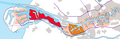
 LocatieNieuweWaterweg.PNG 487 × 620; 42 KB
-
 Location Nieuwe Waterweg.PNG 580 × 772; 77 KB
-
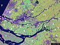
 Maasmonding met De Beer ca 1910 W.H. Hoekwater.JPG 1,515 × 1,222; 282 KB
-
 Nieuwe Waterwag.jpg 374 × 239; 23 KB
-
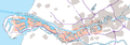
 Nieuwe Waterweg Maasmond Location osm.png 927 × 443; 432 KB
-
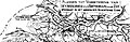 Overzichtsontwerp Nieuwe Waterweg conversie.JPG 1,094 × 355; 151 KB
-
 RMSDeltaNorth.jpg 800 × 600; 169 KB
-
 Rotterdam en de nieuwe waterweg naar zee, 1857.jpg 3,023 × 1,944; 561 KB
-
 Rozenburg 1867.gif 1,600 × 1,396; 245 KB
-
 TA RIV 069 Kaart Nieuwe Waterweg 1908 (cropped, colorized).jpg 12,364 × 4,037; 20.98 MB
-
 TA RIV 069 Kaart Nieuwe Waterweg 1908 (cropped, mark Botlek).jpg 7,168 × 2,341; 13.31 MB
-
 TA RIV 069 Kaart Nieuwe Waterweg 1908.jpg 12,833 × 4,633; 12.45 MB
-
 Vaargeul Nieuwe Waterweg.JPG 790 × 719; 107 KB
-
 Vierde Petroleumhaven.png 798 × 376; 15 KB
-
 Waterweg van Rotterdam naar zee, 1870-1880.jpg 1,349 × 653; 137 KB
-
 Zevende Petroleumhaven.PNG 798 × 376; 27 KB


.png)
.png)
.jpg)
.jpg)