Category:Maps of the Nggela islands
Jump to navigation
Jump to search
Media in category "Maps of the Nggela islands"
The following 13 files are in this category, out of 13 total.
-
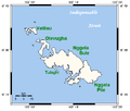 NggelaSolomons.png 534 × 453; 8 KB
-
 Solomon island - Guadalcanal - Florida map - en.svg 1,060 × 896; 150 KB
-
 Проливы Нггела, Силарк, Ленго.svg 935 × 619; 131 KB
-
 Саво, Нггела и окрестности.svg 914 × 737; 268 KB
-
 Admiralty Chart No 1469 Guadalcanal and Florida Island, Published 1893, Large Corrections 1932.jpg 16,135 × 11,064; 43.25 MB
-
 Florida and Tulagi Islands Map.jpg 584 × 413; 83 KB
-
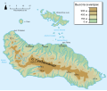
 Florida and Tulagi Islands.jpg 1,160 × 1,671; 330 KB
-
 Guadalcanal & Florida Island map - mk.svg 533 × 449; 137 KB
-
 OSM 2023 Solomons Central.png 2,202 × 706; 378 KB
-
 Guadalcanal & Florida Island map - es.svg 533 × 449; 377 KB
-
 Guadalcanal & Florida Island map - fr.svg 533 × 449; 146 KB
-
 Solomon island - Guadalcanal - Florida map-ru.svg 533 × 449; 183 KB
-
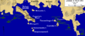 TulagiGavutuLandings.gif 520 × 227; 42 KB


