Category:Maps of the New Georgia Islands
Jump to navigation
Jump to search
Media in category "Maps of the New Georgia Islands"
The following 18 files are in this category, out of 18 total.
-
 Admiralty Chart No 2601 New Georgia Wana Wana to Nbulo Island, Published 1895.jpg 7,456 × 4,968; 4.67 MB
-
 Admiralty Chart No 2392 New Georgia Vella Lavella to Wana Wana, Published 1896.jpg 4,208 × 5,816; 2.72 MB
-
 Admiralty Chart No 1469 Guadalcanal Island to New Georgia Group, Published 1954.jpg 16,155 × 10,999; 16.66 MB
-
 Admiralty Chart No 3208 New Georgia Blackett Strait to Mongo Entrance, Published 1901.jpg 7,160 × 5,397; 4.28 MB
-
 Admiralty Chart No 3402 Santa Isabel Island to New Georgia Group, Published 1955, New Edition 1968.jpg 11,262 × 16,457; 12.43 MB
-
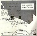 Airfield at Munda Point.jpg 1,090 × 1,067; 294 KB
-
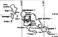
 Blacket Strait.JPG 832 × 512; 67 KB
-
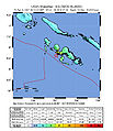 Intensity04.06.07.jpg 612 × 710; 105 KB
-
 Kolombangara General.png 5,400 × 5,400; 24.1 MB
-

-
 New Georgia Group.jpg 2,941 × 1,317; 594 KB
-
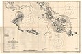
 New Georgia Island Group Map.jpg 548 × 349; 69 KB
-
 New Georgia Island Group.jpg 1,127 × 1,664; 305 KB
-
 NewGeorgiaGroupCloseup esp.jpg 3,868 × 2,520; 1.42 MB
-
 NewGeorgiaGroupCloseup.png 967 × 630; 45 KB
-
 NewGeorgiaGroupCloseup2.JPG 967 × 630; 87 KB
-
 NewGeorgiaIslands2022OSM.png 5,755 × 3,963; 9.84 MB
-
 OSM 2023 Solomons Western.png 2,672 × 1,921; 1.92 MB


