Category:Maps of the Netherlands by year
Jump to navigation
Jump to search
Subcategories
This category has the following 35 subcategories, out of 35 total.
.
- 1538 maps of the Netherlands (1 F)
- 1549 maps of the Netherlands (1 F)
- 1558 maps of the Netherlands (1 F)
- 1560 maps of the Netherlands (2 F)
- 1570 maps of the Netherlands (1 F)
- 1591 maps of the Netherlands (1 F)
- 1600 maps of the Netherlands (3 F)
- 1622 maps of the Netherlands (1 F)
- 1642 maps of the Netherlands (empty)
- 1698 maps of the Netherlands (empty)
- 1747 maps of the Netherlands (5 F)
- 1899 maps of the Netherlands (3 F)
- 1916 maps of the Netherlands (1 F)
- 1919 maps of the Netherlands (1 F)
- 1949 maps of the Netherlands (3 F)
- 1952 maps of the Netherlands (2 F)
- 1955 maps of the Netherlands (1 F)
- 1956 maps of the Netherlands (1 F)
- 1966 maps of the Netherlands (1 F)
- 1987 maps of the Netherlands (1 F)
- 1990 maps of the Netherlands (1 F)
- 2013 maps of the Netherlands (2 F)
- 2014 maps of the Netherlands (1 F)
- 2015 maps of the Netherlands (3 F)
- 2020 maps of the Netherlands (1 F)
- 2021 maps of the Netherlands (2 F)
- 2023 maps of the Netherlands (3 F)
- 2024 maps of the Netherlands (2 F)
Pages in category "Maps of the Netherlands by year"
This category contains only the following page.
Media in category "Maps of the Netherlands by year"
This category contains only the following file.
-
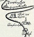
Kuinre en imgeving in 1534.jpg 542 × 592; 120 KB