Category:Maps of the Moon
Appearance
map representing the Moon | |||||
| Upload media | |||||
| Subclass of | |||||
|---|---|---|---|---|---|
| Depicts | Moon | ||||
| |||||
Subcategories
This category has the following 10 subcategories, out of 10 total.
G
- Geological maps of the Moon (12 F)
L
M
- Mascons (27 F)
O
S
- SVG maps of the Moon (22 F)
T
- TLPs (27 F)
- Topographic maps of the Moon (119 F)
Media in category "Maps of the Moon"
The following 135 files are in this category, out of 135 total.
-
"Oceanus Procellarum Base Here - The Eagle Has Landed" (LROC1122).jpg 1,100 × 831; 375 KB
-
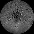
14079-LunarNorthPoleMosaic-LRO-20140318.jpg 2,331 × 1,819; 935 KB
-
Map of moon's crust.jpg 2,343 × 1,757; 806 KB
-
PIA16589 - Olivine materials mapped to thin moon crust.jpg 1,720 × 1,290; 2.02 MB
-
PIA16588 - Closer Look at Lunar Highland Crust.jpg 1,475 × 975; 1.34 MB
-
25 Euro Österreich 2009 Astronomie 86.jpg 880 × 880; 342 KB
-
A Lunar Donut- Bell E Crater (LROC1151 - content Kreep).png 1,100 × 640; 616 KB
-
A Rain of Rock (LROC1149 - content FI-vavilov topography scaled).png 1,100 × 604; 720 KB
-
Aitken crater.jpg 953 × 1,095; 906 KB
-
BeharQamar.png 2,000 × 1,500; 930 KB
-
Bečvář map - legend.jpg 332 × 49; 13 KB
-
Bečvář map.jpg 682 × 422; 72 KB
-
Carte faces lunaires.jpg 1,559 × 600; 130 KB
-
Carte Lune mers crateres contraste.png 800 × 800; 491 KB
-
Carte Lune mers crateres.jpg 800 × 800; 136 KB
-
Carte simplifiée de la lune (fr).png 826 × 1,169; 576 KB
-
CGI Moon Kit - Ldem 64 uint.tif 23,040 × 11,520; 506.34 MB
-
CGI Moon Kit - Ldem 64.tif 23,040 × 11,520; 1,012.59 MB
-
CGI Moon Kit - Lroc color poles.tif 27,360 × 13,680; 494.09 MB
-
Clementine albedo simp750.jpg 1,080 × 540; 204 KB
-
Compton-Belkovich Thorium Anomaly.jpg 475 × 397; 170 KB
-
Cool Cold Spots (LROC1010 - content williams figure-2).jpg 1,100 × 533; 575 KB
-
Copernican System farside plate 11B Wilhelms1987.jpg 1,968 × 1,988; 563 KB
-
Copernican System nearside plate 11A Wilhelms1987.jpg 1,988 × 2,004; 531 KB
-
CráterBoole(Moon).png 2,193 × 1,140; 2.45 MB
-
CráterCrookes(General).png 1,389 × 848; 1.33 MB
-
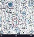
Cráteres Catalán en mapa de la luna.jpg 602 × 599; 166 KB
-
De-Mondkarte.ogg 2.3 s; 21 KB
-
Delicate patterns in Giordano Bruno ejecta (LROC267).jpg 1,156 × 1,023; 1.08 MB
-
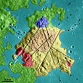
Detail of geologic units on USGS Moon Geologic Map of the Maskelyne DA Region.jpg 6,016 × 4,016; 12.55 MB
-
Detail of landing site on USGS Moon Geologic Map of the Maskelyne DA Region.jpg 6,016 × 4,016; 14.45 MB
-
Detail of Maskelyne DA Crater on USGS Moon Geologic Map of the Maskelyne DA Region.jpg 6,016 × 4,016; 14.88 MB
-
Detail of USGS Moon Geologic Map of the Maskelyne DA Region.jpg 6,016 × 4,016; 16.31 MB
-
Diocese of Orlando map (including moon).png 1,214 × 1,148; 336 KB
-
FraMauroformationmap.jpg 2,992 × 2,701; 1.46 MB
-
Full moon by Claude Mellan 1635.jpg 3,050 × 3,462; 4.1 MB
-
Full Moon Japan-2.jpg 3,652 × 2,700; 2.65 MB
-
Full-moon copy.jpg 555 × 566; 73 KB
-
GIS example map of the moon.png 787 × 393; 248 KB
-
High Resolution Maps of the Moon (LROC982 - NAC DTM TSILKVSKIY2 CLRSHADE 20170911 164042).tiff 3,504 × 16,239; 162.82 MB
-
Imbrium mas.png 220 × 279; 18 KB
-
JohannNepomukKrieger-MondAtlas.jpg 490 × 599; 114 KB
-
Kuu merede ja kraatrite nimedega.png 2,500 × 1,669; 6.59 MB
-
LAM2 CMP-flown.jpg 3,188 × 2,550; 2.61 MB
-
Location of Lunar Seismometers.png 467 × 467; 262 KB
-
LRO WAC North Pole Mosaic (PIA14024).jpg 18,622 × 18,622; 79.37 MB
-
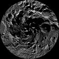
LRO WAC South Pole Mosaic.jpg 6,082 × 6,082; 10.84 MB
-
Luna en proyección ortográfica.jpg 8,584 × 4,924; 12.49 MB
-
Lunar Chart (LPC-1) 2nd Edition February 1979.png 11,351 × 7,789; 95.59 MB
-
Lunar Earthside Map - 3rd Edition - 1976 - NASA.jpg 2,000 × 1,401; 3.67 MB
-
Lunar impacts.jpg 1,306 × 1,306; 249 KB
-
Lunar nearside-eastern section.png 833 × 1,278; 609 KB
-
Lunar quadrangle layout for 1 to 1000000 scale.png 783 × 681; 355 KB
-
Lunar quadrangle layout.jpg 1,053 × 558; 272 KB
-
Lunar site selection globe.jpg 507 × 406; 43 KB
-
Lunar south pole summer annotated.jpg 2,376 × 1,600; 701 KB
-
Lunar south pole.jpg 2,999 × 3,199; 932 KB
-
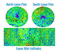
Lunar Thorium concentrations.jpg 2,100 × 1,100; 817 KB
-
Lunar Topophotomap 1-10000.jpg 730 × 516; 83 KB
-
Lunar Topophotomap 1-50000 Detalle.jpg 2,502 × 1,332; 822 KB
-
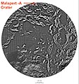
Lunar-south-pole--with-malapert-a-crater.jpg 1,582 × 1,700; 730 KB
-
Lunarhydrogen2-med.jpg 500 × 447; 101 KB
-
LuneVisible.png 728 × 728; 1,013 KB
-
Map - Lunar Samples (S70-28115).jpg 4,450 × 3,480; 2.22 MB
-
Map folder for USGS lunar geologic maps.jpg 4,016 × 4,016; 8.9 MB
-
Mapping the Moon (3116113794).jpg 800 × 800; 507 KB
-
Moon (4996309863).jpg 2,000 × 1,000; 1.52 MB
-
Moon crustal thickness map NASA-JPL.jpg 2,120 × 1,364; 1.79 MB
-
Moon divided by regions.jpg 2,347 × 1,658; 352 KB
-
Moon ER magnetic field it.jpg 800 × 578; 456 KB
-
Moon ER magnetic field-vi.jpg 800 × 578; 139 KB
-
Moon ER magnetic field.jpg 800 × 578; 339 KB
-
Moon gravity acceleration map LGM2011.jpg 1,395 × 800; 448 KB
-
Moon landing map surveyor-ru.svg 1,100 × 1,070; 370 KB
-
Moon Map - Equatorial region 45S to 45N - LPC1 - NASA-Eötvös.jpg 1,014 × 1,083; 167 KB
-
Moon Map - Equatorial region 45S to 45N - LPC1 - NASA.jpg 11,104 × 3,280; 6.19 MB
-
Moon Map - LPC1 - NASA.jpg 11,351 × 7,789; 10.83 MB
-
Moon Map - Northern polar region - LPC1 - NASA.jpg 3,712 × 3,728; 1.66 MB
-
Moon Map - Northern pole - LPC1 - NASA.jpg 1,244 × 1,228; 257 KB
-
Moon Map - Southern polar region - LPC1 - NASA.jpg 3,664 × 3,648; 1.72 MB
-
Moon map at NMC.jpg 2,400 × 1,600; 1.61 MB
-
Moon map grid showing artificial objects on moon.PNG 2,560 × 1,440; 510 KB
-
Moon map ncas.png 458 × 555; 479 KB
-
Moon Map.jpg 835 × 437; 92 KB
-
Moon names bg.svg 512 × 384; 37 KB
-
Moon names lv.jpg 796 × 600; 74 KB
-
Moon names pl.jpg 800 × 800; 212 KB
-
Moon names.jpg 800 × 800; 64 KB
-
Moon North Pole.jpg 7,738 × 7,730; 5.23 MB
-
Moon PIA00302.jpg 1,719 × 1,719; 259 KB
-
Moon PIA00303.jpg 1,719 × 1,719; 297 KB
-
Moon PIA00304.jpg 1,719 × 1,719; 311 KB
-
Moon PIA00305.jpg 1,719 × 1,719; 285 KB
-
Moon Soft Landings.svg 4,659 × 4,627; 411 KB
-
Moon South Pole no Legend.jpg 7,943 × 7,943; 7.18 MB
-
Moon texture.jpg 27,360 × 13,680; 62.57 MB
-
Moon-map.JPG 600 × 600; 64 KB
-
Moon-map.png 936 × 936; 149 KB
-
Moon-names-sv.jpg 800 × 800; 88 KB
-
Moondisk main visible details.png 401 × 406; 331 KB
-
MoonLanderClem.jpg 3,650 × 2,263; 7.48 MB
-
MoonLanderLola16.png 3,650 × 2,592; 13.57 MB
-
Moonmap from clementine data named+.jpg 1,440 × 720; 425 KB
-
Moonmap from clementine data.png 1,440 × 720; 902 KB
-
MoonMap1.jpg 1,758 × 1,328; 929 KB
-
Moonthorium-med.jpg 500 × 340; 69 KB
-
MoonVisibleLibration.jpg 1,500 × 1,060; 501 KB
-
Neutrons strip2.jpg 476 × 302; 30 KB
-
O'Day lunar crater.jpg 800 × 600; 179 KB
-
One Section of the Index Map-AS15(9625&9630).jpg 718 × 421; 218 KB
-
Our Moon (1740380996).jpg 807 × 1,024; 332 KB
-
Photo of USGS Moon Geologic Map of the Maskelyne DA Region.jpg 6,010 × 4,012; 14.23 MB
-
PIA18822-LunarGrailMission-OceanusProcellarum-Rifts-Overall-20141001.jpg 1,500 × 1,500; 199 KB
-
Planetarium (9).jpg 768 × 1,024; 156 KB
-
RobertCrater.jpg 2,360 × 1,304; 601 KB
-
Solarsystemscope texture 2k moon.jpg 2,048 × 1,024; 1.01 MB
-
Solarsystemscope texture 8k moon.jpg 8,192 × 4,096; 14.33 MB
-
South Ray crater contour map p115a.jpg 366 × 376; 49 KB
-
The formations of the Moon.png 960 × 720; 456 KB
-
Topographic map of the far side of the Moon.png 4,735 × 4,717; 9.71 MB
-
Traversing the Shackleton de Gerlache Ridge (LROC1247 - content geomap snippet).png 1,100 × 1,100; 1.39 MB
-
USSR Moon Stamp 1959.jpg 374 × 529; 36 KB
-
Wac nearside anot.png 1,400 × 1,400; 1.14 MB
-
Water Around Fresh Moon Crater.jpg 611 × 352; 122 KB
-
Water Detected at High Latitudes on the Moon.jpg 1,950 × 1,950; 536 KB
-
Карта Луны.jpg 6,416 × 5,981; 8.72 MB


