Category:Maps of the Mexican-American War
Jump to navigation
Jump to search
Media in category "Maps of the Mexican-American War"
The following 91 files are in this category, out of 91 total.
-
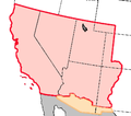
Mexican Cession.png 2,328 × 1,541; 2.81 MB
-
191 of 'The War with Mexico' (11030261016).jpg 1,544 × 2,593; 1.14 MB
-
253 of 'The War with Mexico' (11030808525).jpg 2,496 × 1,502; 1.12 MB
-
Battalionmap.png 1,000 × 643; 90 KB
-
Battle of Buena Vista D012.jpg 3,922 × 2,648; 730 KB
-
Battle of Chapultepec - es.svg 955 × 987; 247 KB
-
Battle of Chapultepec - ru.svg 955 × 987; 263 KB
-
Battle of Contreras.jpg 3,429 × 2,451; 3.24 MB
-
Battle of Contreras.png 1,008 × 658; 1.2 MB
-
Battle of Palo Alto map.jpg 2,448 × 3,264; 2.43 MB
-
Battle Buena Vista map.png 506 × 498; 173 KB
-
Battle of Cerro Gordo Map.png 819 × 399; 162 KB
-
Battle of Chapultepec map.png 604 × 577; 432 KB
-
Chihuahua 1846-1848-en.svg 471 × 847; 19 KB
-
Chihuahua 1846-1848.svg 471 × 847; 19 KB
-
Chihuahua1846-1848-es.svg 471 × 847; 202 KB
-
Battle of Churubusco Map.png 242 × 397; 159 KB
-
Battle of Contreras Map.png 469 × 384; 359 KB
-
ElBrazito Doniphan map.jpg 608 × 403; 140 KB
-
G4360 1851 (16556067773).jpg 1,528 × 2,129; 977 KB
-
HHBHM V5 D374 Battlefield of Palo Alto.jpg 1,804 × 1,272; 536 KB
-
HHBHM V5 D398 Field of Taylor's Campaign.jpg 1,830 × 2,026; 1.02 MB
-
HHBHM V5 D401 City of Monterey.jpg 1,847 × 1,201; 490 KB
-
HHBHM V5 D427 Chihauhua.jpg 1,814 × 2,198; 882 KB
-
HHBHM V5 D441 Battlefield of Buena Vista.jpg 1,810 × 1,233; 438 KB
-
HHBHM V5 D463 Vera Cruz.jpg 1,816 × 1,610; 746 KB
-
HHBHM V5 D474 Battle field of Cerro Gordo.jpg 1,814 × 1,289; 534 KB
-
HHBHM V5 D479 Scott's March to Puebla.jpg 1,838 × 1,698; 572 KB
-
HHBHM V5 D490 Valley of Mexico.jpg 1,815 × 3,158; 1.13 MB
-
HHBHM V5 D519 Mexico City and vicinity.jpg 2,953 × 1,778; 494 KB
-
HHBHM V5 D546 Guerrero.jpg 1,895 × 1,081; 622 KB
-
HHBHM V5 D569 Paredes Last campaign.jpg 1,825 × 1,476; 457 KB
-
JalapaAction.jpg 382 × 287; 45 KB
-
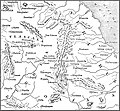
Location of Buena Vista.jpg 371 × 396; 60 KB
-
Location of El Brazito.jpg 429 × 402; 40 KB
-
Map of contreras and churubusco.png 1,130 × 691; 218 KB
-
McConnell's Historical maps of the United States LOC 2009581130-29.jpg 13,272 × 9,438; 17.96 MB
-
McConnell's Historical maps of the United States LOC 2009581130-30.jpg 13,162 × 9,522; 18.76 MB
-
Mexican war overview.gif 1,728 × 1,744; 325 KB
-
Mexican–American War (without Scott's Campaign)-en.svg 1,433 × 1,230; 610 KB
-
Mexican–American War(without Scott's Campaign)-ru.svg 1,430 × 1,230; 608 KB
-
Mexican–American War-de.svg 1,571 × 1,230; 1.95 MB
-
Mexican–American War-en.svg 1,571 × 1,230; 675 KB
-
Mexican–American War-hu.svg 1,571 × 1,230; 673 KB
-
Mexican–American War-ru.svg 1,571 × 1,230; 674 KB
-
Mexican–American War-uk.svg 1,571 × 1,230; 674 KB
-
Battle Molino del Rey map.png 655 × 421; 352 KB
-
Battle of Monterrey.png 505 × 499; 351 KB
-
Battle Palo Alto map.png 282 × 302; 161 KB
-
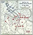
Battle Resaca de la Palma map.jpg 283 × 306; 34 KB
-
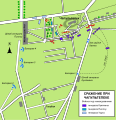
Sacramento map Doniphan.jpg 658 × 399; 131 KB
-
Battle of San Pascual.gif 429 × 600; 29 KB
-
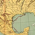
Santa Anna's Advance to San Jacinto.jpg 2,156 × 1,385; 446 KB
-
SantaFe2.jpg 615 × 400; 172 KB
-
Schieble Mexican War Map.jpg 5,421 × 3,456; 4.52 MB
-
Mexican war scott march to sept 1847.jpg 1,311 × 997; 207 KB
-
Scott's Campaign March to September 1847.PNG 681 × 261; 36 KB
-
Scott's campaign (Veracruz - Puebla) - ru.svg 1,917 × 818; 840 KB
-
Scott's campaign-en.svg 1,411 × 541; 71 KB
-
Scott's campaign-es.svg 1,411 × 541; 323 KB
-
Scott's campaign-hu.svg 1,411 × 541; 74 KB
-
Scott's campaign-ru.svg 1,411 × 541; 72 KB
-
Siege map of Fort Texas.jpg 432 × 383; 72 KB
-
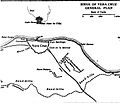
Siege of Vera Cruz.jpg 407 × 348; 50 KB
-
Mexican war map summary 1846 1847.jpg 1,311 × 1,015; 202 KB
-
Mexican war map 14.jpg 1,308 × 1,009; 214 KB
-
Mexican war map august september 1847.jpg 1,320 × 1,015; 212 KB
-
Teksas-Cumhuriyeti.svg 333 × 410; 109 KB
-
TSOM D361 Siege of Vera Cruz.png 2,630 × 1,433; 373 KB
-
TSOM D367 Battle of Molino del Rey.png 2,587 × 1,407; 523 KB
-
TSOM D369 Storming of Chapultepec.png 2,703 × 1,460; 565 KB
-
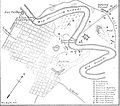
Siege of Veracruz Map.PNG 473 × 397; 283 KB
-
Wpdms mexican cession.png 301 × 265; 30 KB
-
Young folks' history of the United States (1903) (14777725235).jpg 2,115 × 3,151; 756 KB
-
Furber & James A New Map of Mexico, California & Oregon 1847-1848 UTA.jpg 3,126 × 4,587; 4.17 MB
-
Furber & Stillman Battle Ground of Cerro Gordo 1846-1848 UTA.jpg 4,773 × 2,982; 4.82 MB
-
Furber & Stillman Plan of Monterey, and Disposition of American Troops 1846-1848 UTA.jpg 4,907 × 3,111; 4.14 MB
-
Furber, Haynes, & Stillman Plan of Matamoras, and Vicinity 1847-1848 UTA.jpg 4,574 × 2,946; 4.31 MB
-
Heller, Leon, & Wilhelmi Karte von Yucatan 1847-1848 UTA.jpg 2,761 × 3,600; 2.61 MB
-
Hughes Map Showing the Route of the Arkansas Regiment 1846-1850 UTA.jpg 3,009 × 2,041; 1.39 MB
-
Kemble & Carleton Map of the country near Buena Vista, Mexico 1847-1848 UTA.jpg 8,197 × 6,476; 18.84 MB
-
Revere & Beechey Harbour of San Francisco California 1846-1849 UTA.jpg 2,246 × 2,868; 1.45 MB
-
Sketch of the River Tabasco 1847-1848 UTA.jpg 5,093 × 7,372; 9.25 MB
-
Unknown & Hughes A New Map of Mexico, California & Oregon 1846-1848 UTA.jpg 2,167 × 2,990; 1.98 MB


