Category:Maps of the Metropolitan Borough of Stockport
Jump to navigation
Jump to search
Subcategories
This category has only the following subcategory.
E
- Election maps of Stockport (25 F)
Media in category "Maps of the Metropolitan Borough of Stockport"
The following 52 files are in this category, out of 52 total.
-
 1910 cheshire odinance survey map showing Edgley Park.jpg 2,959 × 4,096; 3.14 MB
-
 1910 Cheshire ordnance survey map showing Edgeley Park (cropped).jpg 2,282 × 2,782; 1.53 MB
-
 Manchestermap 1924.jpg 3,504 × 2,544; 2.81 MB
-
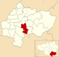
 Bramhall North (Stockport Council Ward).png 1,754 × 1,713; 340 KB
-
 Bramhall South (Stockport Council Ward).png 1,754 × 1,713; 342 KB
-
 Bredbury & Woodley (Stockport Council Ward).png 1,754 × 1,713; 341 KB
-
 Bredbury Green & Romiley (Stockport Council Ward).png 1,754 × 1,713; 342 KB
-
 Brinnington & Central (Stockport Council Ward).png 1,754 × 1,713; 342 KB
-
 Cheadle & Gatley (Stockport Council Ward).png 1,754 × 1,713; 341 KB
-
 Cheadle Hulme North (Stockport Council Ward).png 1,754 × 1,713; 340 KB
-
 Cheadle Hulme South (Stockport Council Ward).png 1,754 × 1,713; 340 KB
-
 Cheadle, Chorlton, Heaton Mersey & Northenden RJD 149.jpg 2,855 × 1,890; 506 KB
-
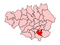
 Cheadle2007Constituency.svg 322 × 242; 305 KB
-
 CheadleConstituency.svg 329 × 242; 76 KB
-
 Davenport & Cale Green (Stockport Council Ward).png 1,754 × 1,713; 339 KB
-
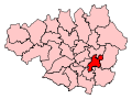 DentonReddish2007Constituency.svg 322 × 242; 305 KB
-
 DentonReddishConstituency.svg 329 × 242; 76 KB
-
 Edgeley & Cheadle Heath (Stockport Council Ward).png 1,754 × 1,713; 339 KB
-
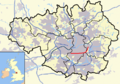
 EnglandStockport.png 200 × 247; 27 KB
-
 GManc-Stockport.png 200 × 151; 15 KB
-
 GreaterManchesterStockport.png 200 × 151; 16 KB
-
 Hazel Grove (Stockport Council Ward).png 1,754 × 1,713; 340 KB
-
 HazelGrove2007Constituency.svg 322 × 242; 305 KB
-
 HazelGroveConstituency.svg 329 × 242; 76 KB
-
 Heald Green (Stockport Council Ward).png 1,754 × 1,713; 340 KB
-
 Heatons North (Stockport Council Ward).png 1,754 × 1,713; 339 KB
-
 Heatons South (Stockport Council Ward).png 1,754 × 1,713; 339 KB
-
 Manchester parish map.svg 913 × 813; 246 KB
-
 Manchester Transport Museum SELNEC Futuroute sign.jpg 2,048 × 1,536; 910 KB
-
 Manor (Stockport Council Ward).png 1,754 × 1,713; 339 KB
-
 Marple North (Stockport Council Ward).png 1,754 × 1,713; 348 KB
-
 Marple South (Stockport Council Ward).png 1,754 × 1,713; 345 KB
-
 Midland to Manchester.jpg 800 × 502; 71 KB
-
 Nico ditch 1895 os map.png 1,680 × 331; 43 KB
-
 Nico Ditch in Greater Manchester.png 800 × 558; 459 KB
-
 Offerton (Stockport Council Ward).png 1,754 × 1,713; 339 KB
-
 Reddish North (Stockport Council Ward).png 1,754 × 1,713; 338 KB
-
 Reddish South (Stockport Council Ward).png 1,754 × 1,713; 340 KB
-
 River Goyt map.png 639 × 638; 268 KB
-
 River Mersey map.png 1,403 × 571; 1.18 MB
-
 River Tame map.png 669 × 660; 361 KB
-
 Stepping Hill (Stockport Council Ward).png 1,754 × 1,713; 340 KB
-
 Stockport Council Wards Numbered.png 1,123 × 1,096; 217 KB
-
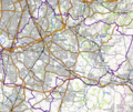
 Stockport OSM 01.png 818 × 644; 665 KB
-
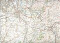
 Stockport OSM 02.png 745 × 627; 862 KB
-
 Stockport OSM 03.png 745 × 627; 610 KB
-
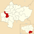
 Stockport UK locator map.svg 1,425 × 993; 860 KB
-
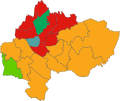
 Stockport UK ward map 2010 (blank).svg 1,336 × 1,305; 394 KB
-
 Stockport UK ward map 2024.svg 687 × 577; 319 KB
-
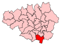
 Stockport2007Constituency.svg 322 × 242; 305 KB
-
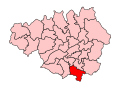
 StockportConstituency.svg 329 × 242; 76 KB
-
 Stockportmap1924.jpg 3,504 × 2,544; 1.73 MB

.jpg)

.png)
.png)
.png)
.png)
.png)
.png)
.png)
.png)


.png)


.png)


.png)


.png)
.png)
.png)

.png)
.png)
.png)


.png)
.png)
.png)


.png)


.svg)