Category:Maps of the Maritsa
Jump to navigation
Jump to search
Media in category "Maps of the Maritsa"
The following 11 files are in this category, out of 11 total.
-
 Evros-Maritsa river map.jpg 436 × 446; 43 KB
-
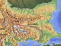 Mariza Balkan topo de.jpg 600 × 450; 254 KB
-
 Arda Mariza-es.svg 956 × 672; 22.49 MB
-
 Arda Mariza.jpg 650 × 550; 106 KB
-
 Greece-Turkey land border-es.svg 512 × 618; 207 KB
-
 Greece–Turkey land border-ar.svg 512 × 618; 474 KB
-
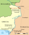
 Greece–Turkey land border.svg 512 × 618; 205 KB
-
 Greek Turkish Bulgarian borders and maritsa river.svg 512 × 599; 85 KB
-
 Marica Map of the Bassin1.jpg 3,508 × 2,478; 1.28 MB
-
 Marica river Bul Map.png 6,993 × 4,500; 1.55 MB
-
 Rhodopen 17.png 1,358 × 793; 1.89 MB


