Category:Maps of the Malay Archipelago by Mercator-Hondius
Jump to navigation
Jump to search
Media in category "Maps of the Malay Archipelago by Mercator-Hondius"
The following 13 files are in this category, out of 13 total.
-
 Map of the East Indies by Jodocus Hondius in 1606.jpg 1,982 × 1,500; 609 KB
-
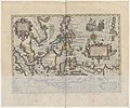
 B26055925A - Insula Indiaorientalis pracipua.jpg 5,591 × 4,052; 7.6 MB
-

-

-
 Atlas Minor Gerardi Mercatoris 1609 (106757922).jpg 5,940 × 4,730; 5.84 MB
-
 Cosmographicae (10534349).jpg 11,985 × 8,201; 30.2 MB
-

-

-

-
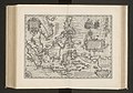
 B26055959H - Insula India orientalis pracipua.jpg 5,681 × 4,220; 6.84 MB
-
-
 Atlas ou Representation du Monde Universel t. 2. 1633 (110102992).jpg 16,937 × 11,904; 32.99 MB
-
 Map of East India by Jodocus Hondius.jpg 1,344 × 978; 721 KB


.jpg)
.jpg)
.jpg)
.jpg)
_-_btv1b53096740c_(531_of_603).jpg)
.jpg)
.jpg)

.jpg)
.jpg)
