Category:Maps of the Lowell Canal System
Jump to navigation
Jump to search
Subcategories
This category has only the following subcategory.
Media in category "Maps of the Lowell Canal System"
The following 38 files are in this category, out of 38 total.
-
-

-
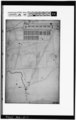
 1836 map of canal system in Lowell, Massachusetts.jpg 500 × 376; 114 KB
-
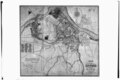 1841 map of Lowell, Massachusetts.tiff 5,000 × 3,322; 15.84 MB
-
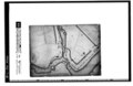
 1846 sketch of proposed canal from Pawtucket Dam to Western Canal; Lowell, MA.tiff 5,000 × 3,208; 15.3 MB
-
 1876 bird's eye view of Lowell, Massachusetts.tiff 5,000 × 3,240; 15.45 MB
-
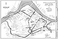
 1975 map of canal system in Lowell, Massachusetts.png 3,371 × 2,252; 1.95 MB
-
 Canal System in Lowell, Massachusetts (evolution).jpg 6,671 × 4,432; 2.87 MB
-
 Canal system in Lowell, Massachusetts.jpg 6,688 × 4,441; 5.5 MB
-

-

-

-

-

-
-

-

-

-
-

-

-

-

-

-

-

-
-

-

-

-

-

-

-

-
-

-

-


.jpg)
