Category:Maps of the London Borough of Islington
Jump to navigation
Jump to search
Media in category "Maps of the London Borough of Islington"
The following 17 files are in this category, out of 17 total.
-
Ashburton Grove.svg 1,069 × 905; 2.67 MB
-
Barbican area map with stations and hotels.png 1,281 × 798; 1.01 MB
-
Boroughs of London Islington.svg 900 × 695; 42 KB
-
Clerkenwell 1805 Cartographer; Tyrer, James.jpg 712 × 758; 253 KB
-
Finsbury Met. B Ward Map 1952.svg 896 × 744; 43 KB
-
Finsbury parishes 1911.png 1,389 × 943; 40 KB
-
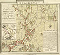
Islington E Baker 1805.jpg 712 × 656; 221 KB
-
Islington London UK blank ward map 2022.svg 512 × 665; 467 KB
-
Islington London UK blank ward map.svg 974 × 1,266; 242 KB
-
Islington London UK labelled ward map 2002.svg 850 × 1,254; 50 KB
-
Islington London UK location map.svg 974 × 1,266; 2.14 MB
-
Islington Met. B Ward Map 1916.svg 886 × 1,088; 61 KB
-
LondonIslington.svg 962 × 744; 19 KB
-
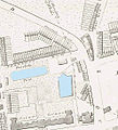
Peerless Pool map.jpg 496 × 544; 71 KB
-
St Giles & Holborn Civil Parish Map 1870.png 7,566 × 4,593; 2.02 MB
-
Survey of the Roads and Foot paths in the Parish of Islington.jpg 3,666 × 5,702; 3.28 MB


