Category:Maps of the London Borough of Hounslow
Jump to navigation
Jump to search
Media in category "Maps of the London Borough of Hounslow"
The following 21 files are in this category, out of 21 total.
-
Brentford and chiswick 1961.png 1,439 × 1,503; 77 KB
-
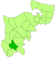
BrentfordandChiswick1961.svg 543 × 550; 24 KB
-
Feltham 1961.png 1,312 × 1,380; 67 KB
-
Feltham1961.svg 543 × 550; 25 KB
-
General Roys Baseline.jpg 909 × 742; 325 KB
-
Glovers map of Brentford battle.jpg 640 × 808; 150 KB
-
Heston isleworth 1961.png 1,441 × 1,503; 77 KB
-
Heston-Isleworth1961.svg 543 × 550; 25 KB
-
Hounslow London UK blank ward map 2022.svg 512 × 338; 17.33 MB
-
Hounslow London UK blank ward map.svg 1,425 × 942; 583 KB
-
Hounslow London UK labelled ward map 2002.svg 1,390 × 921; 112 KB
-
Hounslow London UK local election 2022 map.svg 512 × 338; 6.57 MB
-
Hounslow London UK location map.svg 1,425 × 942; 5.03 MB
-
Isleworth map.jpg 538 × 497; 73 KB
-
John Rocque plan of Chiswick.jpg 473 × 355; 73 KB
-
KingsGreatWorksSheen.jpg 2,063 × 2,579; 678 KB
-
LondonHounslow.svg 962 × 744; 19 KB
-
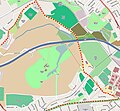
Map-Osterley2.JPG 803 × 745; 103 KB
-
Map-Spring-Grove-2.png 577 × 301; 101 KB
-
Plan du Jardin et Vue des Maisons de Chiswick - crop.jpg 711 × 516; 331 KB
-
Plan du Jardin et Vue des Maisons de Chiswick.jpg 764 × 519; 124 KB


