Category:Maps of the London Borough of Ealing
Jump to navigation
Jump to search
Media in category "Maps of the London Borough of Ealing"
The following 17 files are in this category, out of 17 total.
-
Acton1961.svg 543 × 550; 25 KB
-
Ealing 1961.png 1,347 × 1,388; 69 KB
-
Ealing Borough Areas Map.tif 496 × 306; 71 KB
-
Ealing London UK blank ward map 2002 to 2022.svg 1,425 × 986; 441 KB
-
Ealing London UK blank ward map 2022.svg 1,425 × 986; 445 KB
-
Ealing London UK labelled ward map 2002.svg 1,390 × 986; 110 KB
-
Ealing London UK location map.svg 1,425 × 986; 3.88 MB
-
Ealing UK locator map.svg 1,425 × 1,140; 1.06 MB
-
Ealing1961.svg 543 × 550; 28 KB
-
EalingActonShepherdsBushConstituency.svg 400 × 310; 272 KB
-
EalingCentralActonConstituency.svg 1,000 × 780; 157 KB
-
EalingNorthConstituency.svg 400 × 310; 272 KB
-
EalingSouthallConstituency.svg 400 × 310; 272 KB
-
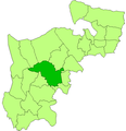
LondonEaling.svg 962 × 744; 19 KB
-
Southall 1961.png 1,446 × 1,503; 78 KB
-
Southall riots, 23 April 1979.png 1,197 × 632; 533 KB
-
Southall1961.svg 543 × 550; 25 KB


