Category:Maps of the Levant
Jump to navigation
Jump to search

Subcategories
This category has the following 7 subcategories, out of 7 total.
+
H
M
O
Media in category "Maps of the Levant"
The following 76 files are in this category, out of 76 total.
-
 1187 Lordship of Toron.svg 512 × 880; 161 KB
-
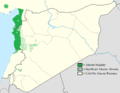
 Alawite Distribution in the Levant greek.png 1,947 × 1,502; 297 KB
-
 Alawite Distribution in the Levant.png 1,947 × 1,502; 304 KB
-
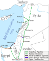 Arab Gas Pipeline.svg 1,816 × 2,256; 620 KB
-
 Black Desert locator map.svg 531 × 709; 185 KB
-
 De Levant.PNG 922 × 991; 210 KB
-
 Estimated population of levant 15000 6000 cal bce 1 1.png 1,226 × 720; 144 KB
-
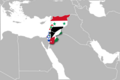 Flag-map of Levant.PNG 1,316 × 879; 179 KB
-
 Flag-map of Levant2.PNG 1,100 × 1,254; 316 KB
-
 Great Palestine.png 1,010 × 506; 13 KB
-
 Israel in Europe.jpg 1,934 × 1,597; 444 KB
-
 Israel in Levant (orthographic projection).jpg 2,000 × 2,000; 849 KB
-
 Israel in Levant (orthographic projection).png 2,000 × 2,000; 679 KB
-
 Israel Palesine.jpg 917 × 1,986; 55 KB
-
 Lazdogotish-levant-flag.png 1,270 × 1,367; 317 KB
-
 Levant (definitions).png 6,460 × 3,403; 1.12 MB
-
 Levant (orthographic projection).png 2,000 × 2,000; 632 KB
-
 Levant 830 nl 3-ar.png 720 × 855; 105 KB
-
 Levant adm location map.svg 638 × 725; 161 KB
-
 Levant.gif 322 × 241; 5 KB
-
 Levante mediterraneo it.svg 500 × 650; 104 KB
-
 Levante mediterraneo.svg 500 × 650; 194 KB
-
 Levantine Arabic 2022.svg 360 × 630; 817 KB
-
 Levantine Arabic 2023.svg 360 × 630; 642 KB
-
 Levantine Arabic Map 2021.jpg 440 × 440; 35 KB
-
 Levantine Arabic Map v4-ar.png 1,042 × 1,696; 399 KB
-
 Levantine Arabic Map v4.png 500 × 814; 46 KB
-
 Levantine Arabic Map.jpg 440 × 440; 49 KB
-
 Levantine Arabic Map.png 500 × 814; 39 KB
-
 Levantine Sea.jpg 627 × 512; 139 KB
-
 LevantineArabic.png 2,000 × 3,500; 178 KB
-
 LevantineArabic.svg 360 × 630; 838 KB
-
 LocationUnitedArabKingdom.png 250 × 115; 6 KB
-
 Map Arabic in the Levant.jpg 440 × 440; 51 KB
-
 Map of the Levant.svg 524 × 524; 417 KB
-
 Mediterania Timur.png 3,421 × 3,890; 561 KB
-
 MELevant.png 538 × 500; 38 KB
-
 MiddleEast A2003031 0820 250m without lines.jpg 2,200 × 2,800; 1.7 MB
-
 MiddleEast.A2003031.0820.250m.jpg 2,200 × 2,800; 1.19 MB
-
 Modern Levant.PNG 554 × 370; 45 KB
-
 Modern Levant.svg 800 × 800; 94 KB
-
 Near east lrg.jpg 2,987 × 3,967; 2.62 MB
-
 Negara Syam (Levant).jpg 1,600 × 1,591; 76 KB
-
 Osman Taksim.jpg 521 × 656; 72 KB
-
 Ottoman ethnographic map of the Levant 1915 (en).png 652 × 1,301; 382 KB
-
 Ottoman ethnographic map of the Levant 1915.jpg 1,475 × 2,399; 876 KB
-
 Palestine base map-ar.png 630 × 600; 341 KB
-
 PAT - The Levant.gif 1,800 × 2,000; 1.15 MB
-
 Petachiah.png 656 × 391; 410 KB
-
 Physical map of Levant and Iraq.svg 1,147 × 515; 5.28 MB
-
 Principle component analysis of Levantine populations.png 4,066 × 2,956; 1.25 MB
-
 Range of Neanderthals in the Levant (crop).png 929 × 347; 123 KB
-
 Range of Neanderthals in the Levant.png 970 × 463; 138 KB
-
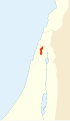
 SevenShiaVillages-ar.png 787 × 475; 52 KB
-
 SevenShiaVillages.png 788 × 479; 15 KB
-
 South Levant.gif 254 × 607; 5 KB
-
 Southeast mediterranean annotated geography.jpg 831 × 1,809; 525 KB
-
 Southern Levant countries map.svg 524 × 524; 397 KB
-
 Southern Levant map.svg 524 × 524; 418 KB
-
 Southern Levant.png 2,000 × 2,833; 189 KB
-
 Sub dialects of Levantine Arabic.png 900 × 862; 200 KB
-
 Tel Abel Beth Maacah.png 1,755 × 2,480; 5.59 MB
-
 The Levant 3-ar.PNG 558 × 600; 116 KB
-
 The Levant 3.png 922 × 991; 290 KB
-
 The Levant-ar.png 558 × 599; 165 KB
-
 The-Levant-is.svg 922 × 991; 76 KB
-
 The-Levant-kk.png 1,000 × 1,075; 159 KB
-
 The-Levant-sr.svg 922 × 991; 91 KB
-
 The-Levant-xmf.png 922 × 991; 143 KB
-
 The-Levant-РУССКИЙ-ЯЗЫК.svg 922 × 991; 91 KB
-
 TransAfrica.PNG 1,276 × 833; 21 KB
-
 Árabe levantino variedades.png 295 × 264; 8 KB
-
 Левант.svg 500 × 650; 194 KB
-
 Турция, конец XIX века.jpg 6,562 × 5,104; 28.46 MB
-
 الشام الجنوبية.jpg 1,184 × 1,580; 426 KB
-
 خريطة قبائل و عشائر الأردن و قبائل الشام و عشائر العراق.jpg 1,152 × 1,984; 476 KB


.jpg)
.png)


.png)
.png)


.jpg)

.png)


.png)