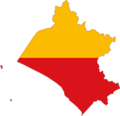
Category:Maps of the Lambayeque Region
Jump to navigation
Jump to search
English: Maps of the Lambayeque Region in Peru
Subcategories
This category has the following 5 subcategories, out of 5 total.
P
S
Media in category "Maps of the Lambayeque Region"
The following 12 files are in this category, out of 12 total.
-
DETALLE GPS JAYANCA.jpg 841 × 664; 279 KB
-
Dibujoyyyyyy.JPG 364 × 463; 25 KB
-
División Politica de Lambayeque.jpg 527 × 761; 45 KB
-
Flag Map of Lambayeque.png 3,249 × 3,129; 47 KB
-
Flag map of provinces of Lambayeque.png 3,249 × 3,129; 1.23 MB
-
Provinces of the Lambayeque region in Peru.png 510 × 578; 21 KB
-
Mapa sierra de Lambayeque.jpg 1,967 × 1,296; 518 KB
-
Mapa ubicación quechuas de Lambayeque.jpg 807 × 531; 151 KB
-
Mapaccaya.jpg 373 × 403; 35 KB
-
Mochumí-límites.jpg 979 × 1,061; 230 KB
-
Mochumí-ubicación.jpg 782 × 890; 144 KB
-
Provinces of Lambayeque.PNG 253 × 284; 6 KB


