Category:Maps of the Kruger Park
Jump to navigation
Jump to search
Media in category "Maps of the Kruger Park"
The following 15 files are in this category, out of 15 total.
-
 (de)Map-South Africa-Kruger Park.svg 744 × 1,052; 242 KB
-
 Afrika Verbreitungsgebiet Lamprotornis australis.png 898 × 801; 483 KB
-
 Farms along Crocodile River ESA418732.tiff 4,326 × 3,090; 51.02 MB
-
 Greater Limpopo Transfrontier Park sketch map.svg 454 × 471; 18 KB
-
 Kruger National Park locator map.svg 2,031 × 1,741; 5.25 MB
-
 Kruger national park panel.jpg 4,032 × 3,016; 4.19 MB
-
 Kruger Nationalpark (de).png 934 × 2,071; 2.44 MB
-
 Lower Sabie Camp Map.png 816 × 726; 112 KB
-
 Map-South Africa-Kruger Park.svg 744 × 1,052; 242 KB
-
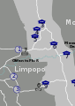
 Map-South Africa-Kruger Park01.png 600 × 940; 218 KB
-
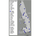 Map-South Africa-Kruger Park02.png 800 × 786; 143 KB
-
 Mapping on OpenStreetMap at the Berg-en-Dal rest camp 2.jpg 4,640 × 2,610; 3.04 MB
-
 South Africa Locator.PNG 329 × 353; 10 KB
-
 The Crocodile River traverses South Africa ESA418736.jpg 10,000 × 5,390; 69.84 MB
-
 ZA-LI-knp.png 439 × 349; 54 KB
Map-South_Africa-Kruger_Park.svg)


.png)


