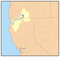
Category:Maps of the Klamath River
Jump to navigation
Jump to search
Pages in category "Maps of the Klamath River"
This category contains only the following page.
Media in category "Maps of the Klamath River"
The following 12 files are in this category, out of 12 total.
-
KlamathRiver watershed.png 469 × 445; 54 KB
-
Klamathmap.jpg 680 × 611; 316 KB
-
KlamathBasin-location.jpg 768 × 1,000; 261 KB
-
Ah Pah Dam project, Klamath river, 1951.svg 512 × 586; 8.63 MB
-
Klamath Basin map.png 1,179 × 1,121; 1.83 MB
-
Klamath Project Mapic.jpg 1,688 × 1,036; 345 KB
-
Klamath River Dams Map (USGS) 2023-08.png 3,300 × 2,550; 9.66 MB
-
KlamathRiver watershed (cropped).png 316 × 316; 45 KB
-
Williamson River and Sprague River Oregon map.jpg 300 × 222; 44 KB
-
Wpdms shdrlfi020l lost river california.jpg 300 × 222; 45 KB
-
Wpdms shdrlfi020l upper klamath lake.jpg 300 × 230; 53 KB
-
Wpdms shdrlfi020l chetco river.jpg 300 × 180; 34 KB


