Category:Maps of the Kingdom of Yugoslavia
Jump to navigation
Jump to search
Subcategories
This category has the following 2 subcategories, out of 2 total.
M
Media in category "Maps of the Kingdom of Yugoslavia"
The following 73 files are in this category, out of 73 total.
-

-
 1935 Yugoslavian parliamentary election - Results by banovina.svg 1,220 × 1,057; 326 KB
-
 1938 Yugoslavian parliamentary election - Results by banovina.svg 1,220 × 1,057; 326 KB
-
 AtlBalk1919.jpg 318 × 327; 151 KB
-
 AtlBalk1922-38.jpg 318 × 327; 146 KB
-
 AtlBalk1940.FA.jpg 318 × 327; 76 KB
-
 AtlBalk1940.jpg 318 × 327; 146 KB
-
 Balkans Animation 1800-2008.gif 744 × 618; 542 KB
-
 Banates and Administrative District of the Kingdom of Yugoslavia (1929-1939).png 2,364 × 2,048; 719 KB
-
 Banates and Administrative District of the Kingdom of Yugoslavia (1939-1941).png 2,364 × 2,048; 719 KB
-
 Carpathian Ruthenia issue, 1938.svg 545 × 385; 116 KB
-
 Carta dimostrativa della Jugoslavia - btv1b53197027n.jpg 14,758 × 11,735; 28.26 MB
-
 Creation of Yugoslavia map with merger dates.svg 1,065 × 771; 452 KB
-
 FormaciónDeYugoslavia-pt.svg 833 × 1,005; 155 KB
-
 FormaciónDeYugoslavia.svg 995 × 688; 1.77 MB
-
 Jugaa.jpg 1,860 × 1,472; 661 KB
-
 Jugo-slavia, 1919.png 3,286 × 3,424; 3.02 MB
-
 Jugoslavia 1918-1922.png 980 × 826; 293 KB
-
 Jugoszlávia domborzati térképe, 1936.svg 800 × 603; 472 KB
-
 Jugosławia 1918-map.png 722 × 624; 41 KB
-
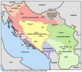
 Kingdom of Serbs, Croats and Slovenes (1918-1929); Kingdom of Yugoslavia (1929-1941).png 2,364 × 2,048; 466 KB
-
 Kingdom of Serbs, Croats and Slovenes (Yugoslavia) blank location map (1918-1922).png 2,364 × 2,048; 600 KB
-
 Kingdom of Serbs, Croats and Slovenes (Yugoslavia) blank location map (1922-1929).png 2,364 × 2,048; 684 KB
-
 Kingdom of Slovenes, Croats and Serbs. Kingdom of Yugoslavia..png 3,560 × 2,816; 578 KB
-
 Kingdom of Yugoslavia 1920.png 1,950 × 1,647; 232 KB
-
 Kingdom of Yugoslavia 1930.svg 450 × 456; 474 KB
-
 Kingdom of Yugoslavia blank location map (1929-1939).png 2,364 × 2,048; 595 KB
-
 Kingdom of Yugoslavia blank location map (1939-1941).png 2,364 × 2,048; 598 KB
-
 Kraljevina SHS 1919.svg 1,065 × 771; 541 KB
-
 Kraljevina Srba, Hrvata i Slovenaca - btv1b8459820r.jpg 9,550 × 8,098; 11.77 MB
-
 KSCS 1921 religion.png 980 × 826; 149 KB
-
 KSCS1921 language.png 980 × 826; 149 KB
-
 Little Entente in Europe 1921-1938.png 2,000 × 2,027; 345 KB
-
 Location Yugoslavia.png 439 × 590; 148 KB
-
 LocationKingdom of Serbs& Croats and Slovenes.png 250 × 115; 7 KB
-
 LocationKingdomYugoslavia.PNG 250 × 115; 6 KB
-
 LocationYugoslavia2.png 250 × 345; 13 KB
-

-

-

-
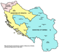
 Locator map of Dalmatia in the Kingdom of Serbs, Croats and Slovenes (1918-1922).png 2,364 × 2,048; 599 KB
-
 Locator map of Montenegro in the Kingdom of Serbs, Croats and Slovenes (1918-1922).png 2,364 × 2,048; 598 KB
-

-
 Locator map of Serbia in the Kingdom of Serbs, Croats and Slovenes (1918-1922).png 2,364 × 2,048; 579 KB
-
 Locator map of Slovenia in the Kingdom of Serbs, Croats and Slovenes (1918-1922).png 2,364 × 2,048; 601 KB
-

-
 Oblasni izbori 1927.jpg 1,000 × 836; 349 KB
-
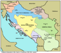
 Oblasts of the Kingdom of Serbs, Croats and Slovenes - Yugoslavia (1922-1929).png 2,364 × 2,048; 893 KB
-
 Occupazione della Jugoslavia.xcf 1,047 × 894; 465 KB
-
 Podjela Kraljevine SHS na 33 oblasti prazna.jpg 1,000 × 836; 341 KB
-
 Podjela Kraljevine SHS na 33 oblasti.jpg 1,000 × 836; 215 KB
-

-
 Map railroads Kingdom SHS.jpg 4,032 × 3,024; 5.9 MB
-
 Scs kingdom oblasts 1922 1929 en.png 1,442 × 1,309; 208 KB
-
 Scs kingdom oblasts 1922 1929 sr.png 1,442 × 1,309; 213 KB
-
 Scs kingdom provinces 1920 1922 en.png 1,076 × 939; 106 KB
-
 Scs kingdom provinces 1920 1922 sr.png 1,076 × 939; 96 KB
-
 Srbsko 1919 es.svg 2,760 × 2,000; 642 KB
-
 Srbsko 1919 pt.svg 1,065 × 771; 557 KB
-
 Srbsko 1919.svg 1,065 × 771; 531 KB
-
 State of Slovenes, Croats and Serbs compared to 1918-1941 Yugoslavia.svg 485 × 406; 424 KB
-
 Yugoslavia (1929-1939) location map.svg 1,220 × 1,057; 407 KB
-
 Yugoslavia (1939-1941) Locator Map.png 1,219 × 1,057; 109 KB
-
 Yugoslavia (1939–41) location map.svg 1,220 × 1,057; 407 KB
-
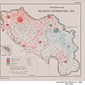 Yugoslavia - Religious Distribution - 1931 - DPLA - de987fd6196335797b1270e280467783.jpg 3,258 × 3,254; 1.45 MB
-
 Yugoslavia proposed banovinas 1939 1941-sr.png 1,051 × 929; 70 KB
-
 Yugoslavia proposed banovinas 1939 1941.png 1,051 × 929; 72 KB
-
 Yugoslavia1936physical.jpg 600 × 452; 362 KB
-
 Zemljevid občin v mariborski oblasti.jpg 2,001 × 1,078; 393 KB
-
-
 Вјерска мапа Краљевине Југославије 1921. године.png 800 × 726; 1.08 MB
-
 Создание Югославии.png 1,066 × 1,039; 316 KB
-
 Создание Югославии.svg 1,067 × 1,040; 466 KB


.png)
.png)


;_Kingdom_of_Yugoslavia_(1929-1941).png)


.png)
.png)
.png)
.png)
.png)
.png)
.png)
.png)
.png)

.png)


.png)


_location_map.svg)
_Locator_Map.png)
_location_map.svg)


_blank_location_map_(1918-1922).png)
_blank_location_map_(1922-1929).png)
.png)
.png)