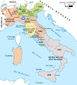
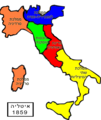
Category:Maps of the Kingdom of Lombardy-Venetia
Jump to navigation
Jump to search
Italiano: Mappe del Regno Lombardo-Veneto.
Subcategories
This category has only the following subcategory.
M
Media in category "Maps of the Kingdom of Lombardy-Venetia"
The following 27 files are in this category, out of 27 total.
-
Italy unification 1815 1870.jpg 1,073 × 1,164; 480 KB
-
Nord Italia1815.jpg 990 × 649; 183 KB
-
Unification of Italy 1815-1870.jpg 813 × 894; 181 KB
-
Unification of Italy 1815-1924.svg 267 × 321; 1.1 MB
-
Völkerkarte von Mittel- und Südosteuropa. Italien 1815 bis zur Gegenwart (1905)-es.svg 2,722 × 2,998; 1.03 MB
-
Völkerkarte von Mittel- und Südosteuropa. Italien 1815 bis zur Gegenwart (1905).jpg 1,574 × 1,886; 600 KB
-
Italia1859-HE.png 1,124 × 1,330; 209 KB
-
Italia1859.png 387 × 387; 7 KB
-
إيطاليا - فخر الدين.PNG 507 × 600; 73 KB
-
Flag map of the Kingdom of Lombardy-Venetia.svg 545 × 268; 70 KB
-
Generalkarte Des Lombardisch-Venetianischen Königreiches 01.jpg 9,679 × 6,419; 21.29 MB
-
Generalkarte Des Lombardisch-Venetianischen Königreiches 02.jpg 9,715 × 6,389; 17.85 MB
-
Generalkarte Des Lombardisch-Venetianischen Königreiches 03.jpg 9,669 × 6,380; 29.08 MB
-
Generalkarte Des Lombardisch-Venetianischen Königreiches 04.jpg 9,656 × 6,418; 27.8 MB
-
Ita-lombven.png 2,048 × 2,458; 269 KB
-
Italy (March 1860).PNG 2,048 × 2,458; 263 KB
-
Italy1816cs.png 1,541 × 1,729; 804 KB
-
Kingdom of Lombardy-Venetia 1815.svg 450 × 456; 700 KB
-
KingdomofLombardy-Venetia.png 423 × 259; 8 KB
-
Lombardo Veneto-pt.svg 700 × 500; 297 KB
-
Lombardo Veneto.svg 700 × 500; 669 KB
-
LombVen.jpg 411 × 312; 51 KB
-
Meyer‘s Zeitungsatlas 008 – Österreich- Lombardisch-Venetisches Königreich.jpg 7,344 × 6,224; 16.82 MB
-
OeLVK0c.png 1,200 × 898; 1.82 MB
-
ReinoLombardoVénetoAustríaco.svg 1,103 × 512; 2.06 MB


