
Category:Maps of the Izu Islands
Media in category "Maps of the Izu Islands"
The following 18 files are in this category, out of 18 total.
-
-

-

-
 Izu Islands and Zenisu Ridge 500m mesh bathymetry.png 1,120 × 840; 1.32 MB
-
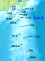 Izu islands.png 300 × 400; 30 KB
-
 Izu-Islands-Japanese-Map.png 1,257 × 1,409; 655 KB
-
 Location IzuIlands.jpg 639 × 698; 244 KB
-
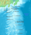
 Map IzuIslandsShuttle.jpg 331 × 523; 32 KB
-
 Map of Izu Islands-de.png 1,257 × 1,409; 693 KB
-
 Map of Izu Islands.png 1,257 × 1,409; 691 KB
-
 Oshima2Ogasawara - OSM Hachijo.png 3,720 × 2,604; 1.67 MB
-
 Oshima2Ogasawara - OSM Miyake.png 2,632 × 2,604; 1.32 MB
-
 Oshima2Ogasawara - OSM Oshima.png 5,020 × 2,600; 2.73 MB
-
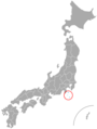 Prefectures of Japan Izu Islands.png 678 × 898; 53 KB
-
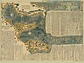 Revised and enlarged map of the Izu Seven Islands (15320020911).jpg 2,500 × 1,870; 2.41 MB
-
 Revised and enlarged map of the Izu Seven Islands.jpg 2,500 × 1,804; 2.31 MB
-
 The Philippine Sea.jpg 569 × 824; 104 KB
-
 Ідзу.gif 331 × 523; 44 KB
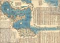
_-_Geographicus_-_IsuIslands-japanese-1730.jpg)


.jpg)


