
Category:Maps of the Iberian Peninsula in the 6th century
Iberian Peninsula (territory of present-day ![]() Spain and
Spain and ![]() Portugal) in 501-600 CE: Maps showing all or a substantial part of the Iberian Peninsula as it was in the 6th century.
Portugal) in 501-600 CE: Maps showing all or a substantial part of the Iberian Peninsula as it was in the 6th century.
Maps of the history of the Iberian Peninsula by century: (BCE) 5th century · 3rd century · 2nd century · 1st century · (CE) 1st century · 2nd century · 3rd century · 4th century · 5th century · 6th century · 7th century · 8th century · 9th century · 10th century · 11th century · 12th century · 13th century · 14th century · 15th century · 16th century · 17th century · 18th century · 19th century · 20th century · 21st century ·
Subcategories
This category has only the following subcategory.
Media in category "Maps of the Iberian Peninsula in the 6th century"
The following 18 files are in this category, out of 18 total.
-
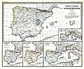 (Spruner-Menke, map 14) The Iberian peninsula 531-711.jpg 3,355 × 2,759; 2.18 MB
-
 Byzantine Spain - 565-586-zh.svg 997 × 555; 111 KB
-
 Byzantine Spain - 565-586.svg 798 × 444; 292 KB
-
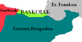 BaskoiakVI mendean.PNG 369 × 192; 25 KB
-
 Britonia6hcentury-ar.jpg 1,670 × 2,928; 375 KB
-
 Britonia6hcentury.png 1,670 × 2,928; 542 KB
-
 Byzantine Spain - 565-586-ru.svg 798 × 444; 363 KB
-
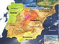
 España bizantina 5-fr.svg 798 × 444; 299 KB
-
 España bizantina 5-hu.svg 3,731 × 2,000; 527 KB
-
 España bizantina 5.svg 3,731 × 2,000; 917 KB
-
 España bizantina-pt.svg 512 × 274; 142 KB
-
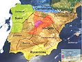
 Hispania sVI.jpg 511 × 357; 42 KB
-
 Hispania3c-ca.svg 1,262 × 1,053; 569 KB
-
 Hispania3c-es.svg 1,262 × 1,053; 542 KB
-
 Hispania3c-gl.jpg 794 × 600; 107 KB
-
 Hispania3c.JPG 883 × 667; 154 KB
-
 Spruner-Menke Handatlas 1880 Karte 14.jpg 3,617 × 2,997; 1.21 MB
-
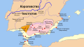
 Suevosevisigodosemportugal.png 870 × 722; 127 KB
_The_Iberian_peninsula_531-711.jpg)


